MyTopo
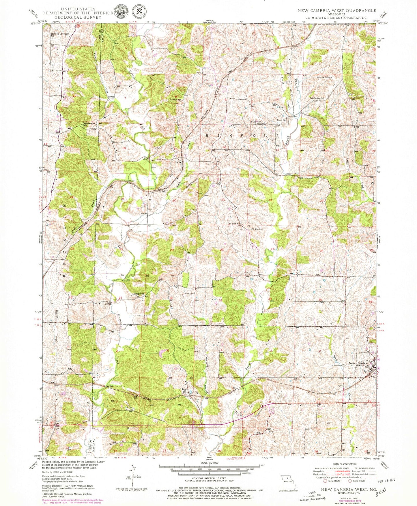
Classic USGS New Cambria West Missouri 7.5'x7.5' Topo Map
Couldn't load pickup availability
Historical USGS topographic quad map of New Cambria West in the state of Missouri. Typical map scale is 1:24,000, but may vary for certain years, if available. Print size: 24" x 27"
This quadrangle is in the following counties: Linn, Macon.
The map contains contour lines, roads, rivers, towns, and lakes. Printed on high-quality waterproof paper with UV fade-resistant inks, and shipped rolled.
Contains the following named places: Brush Creek Cemetery, Clear Creek, Commercial School, Dowell Cemetery, Dutch Creek, Fairbanks School, Hickory Branch, King School, Little Brush Creek, Lundy School, Mission Covenant Church, Mount Zion Cemetery, Mount Zion Church, New Cambria, Painter Creek, Saint Mary Cemetery, Tuttle Cemetery, Zion School (historical), Palmyra School (historical), Lingo School (historical), Johnson School (historical), Manheart School (historical), Lingo, Hart, White Lake Dam, Number 37 Lake, Township of Russell, City of New Cambria, New Cambria Volunteer Fire Department