MyTopo
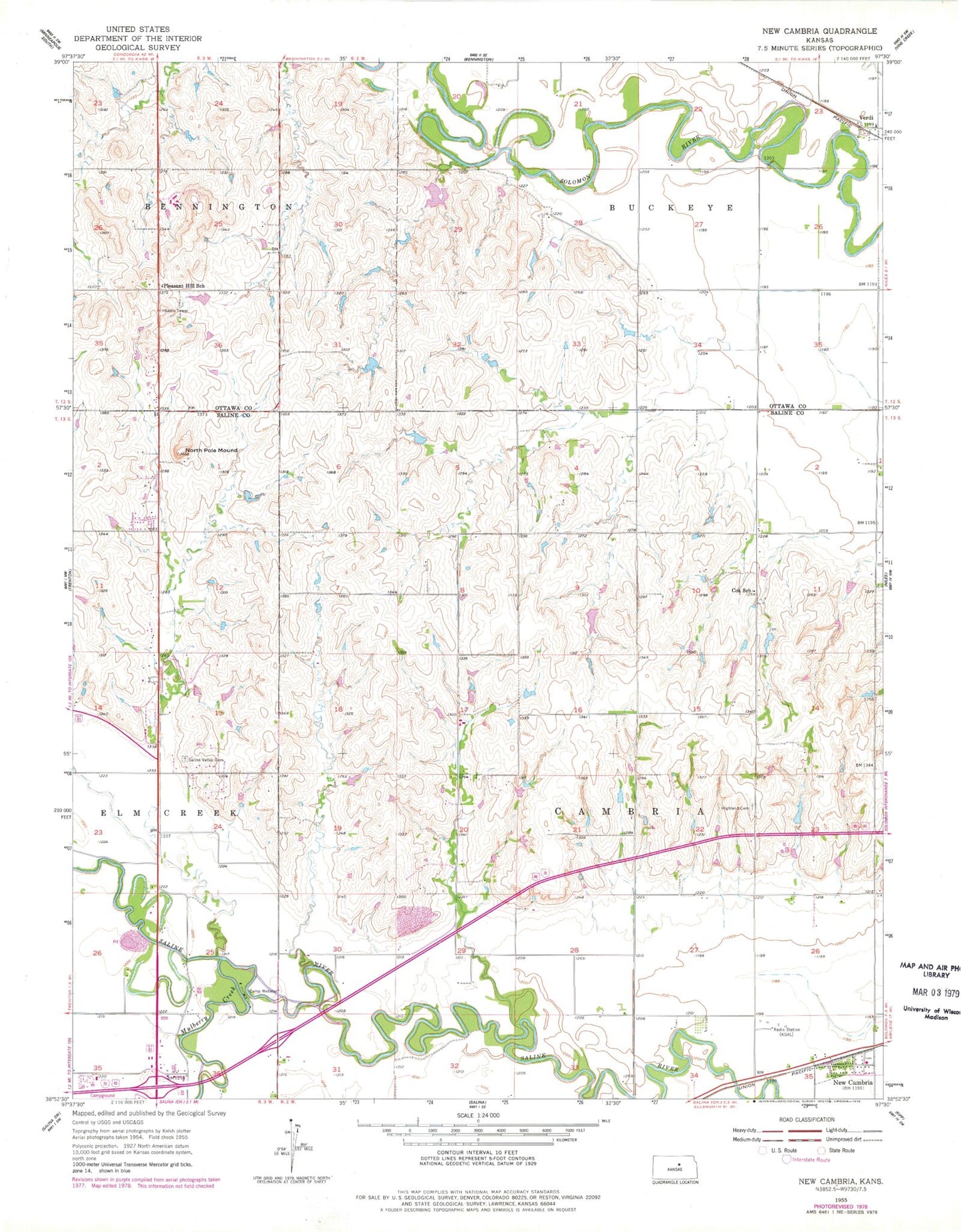
Classic USGS New Cambria Kansas 7.5'x7.5' Topo Map
Couldn't load pickup availability
Historical USGS topographic quad map of New Cambria in the state of Kansas. Map scale may vary for some years, but is generally around 1:24,000. Print size is approximately 24" x 27"
This quadrangle is in the following counties: Ottawa, Saline.
The map contains contour lines, roads, rivers, towns, and lakes. Printed on high-quality waterproof paper with UV fade-resistant inks, and shipped rolled.
Contains the following named places: Arland Airport, Camp Webster, Central Kansas Flywheels Yesteryear Museum, City of New Cambria, Cox School, Highland Cemetery, Humbargar Cemetery, Humbargar School, KSAL-AM (Salina), KYEZ-FM (Salina), Mulberry Creek, New Cambria, New Cambria Post Office, North Pole Mound, Pleasant Hill School, Salina Kampgrounds of America, Saline County Fire District 7, Schipple School, Township of Cambria, Verdi, ZIP Code: 67470