MyTopo
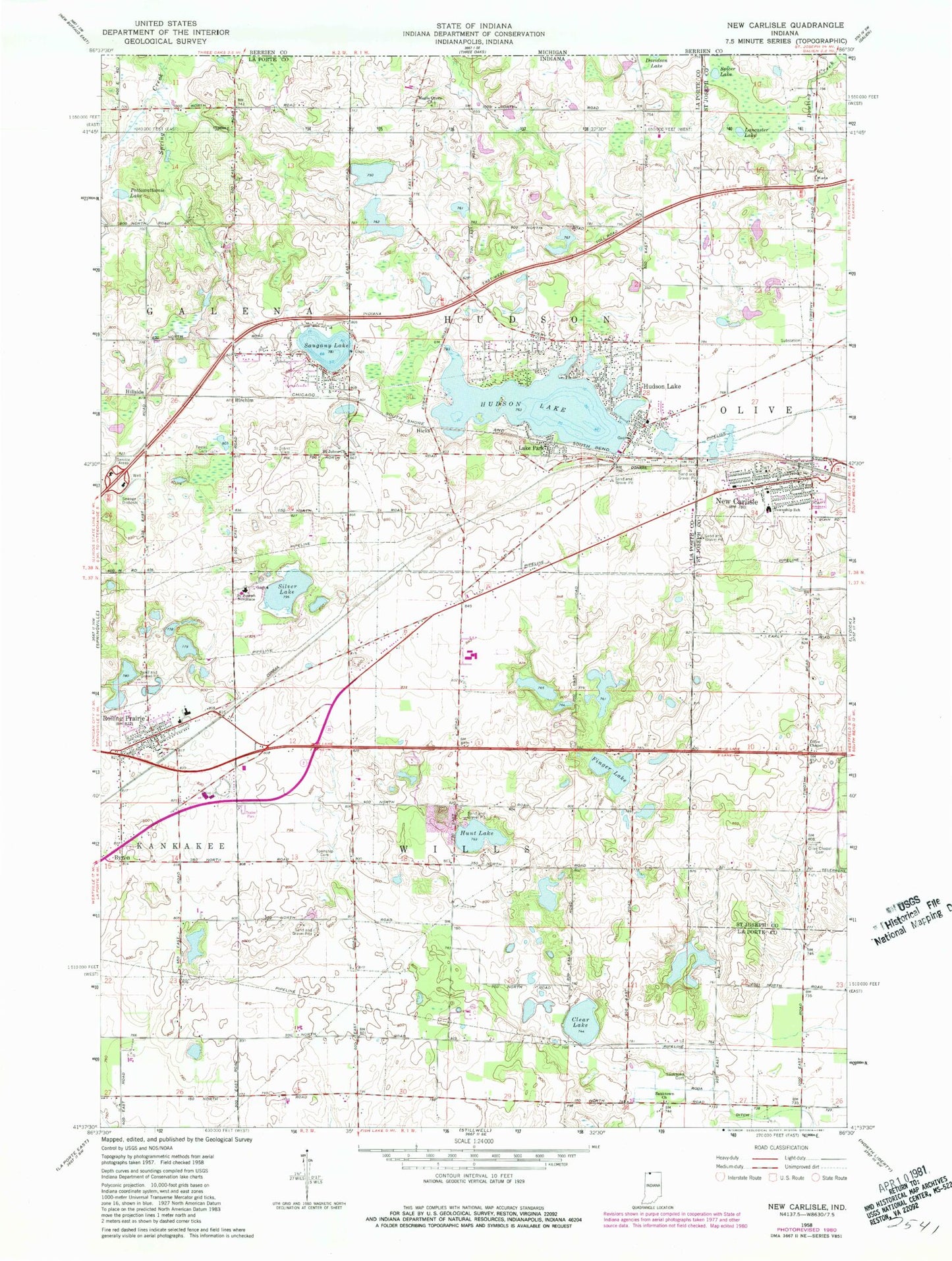
Classic USGS New Carlisle Indiana 7.5'x7.5' Topo Map
Couldn't load pickup availability
Historical USGS topographic quad map of New Carlisle in the state of Indiana. Map scale may vary for some years, but is generally around 1:24,000. Print size is approximately 24" x 27"
This quadrangle is in the following counties: LaPorte, St. Joseph.
The map contains contour lines, roads, rivers, towns, and lakes. Printed on high-quality waterproof paper with UV fade-resistant inks, and shipped rolled.
Contains the following named places: Birchim, Byron, Clear Lake, Cummings Field, Finger Lake, Hicks, Hillside, Hudson Lake, Hudson Lake Census Designated Place, Hudson Lake Elementary School, Hunt Lake, Hunt Lake Pit, Kankakee Township Volunteer Fire Department, Lake Park, Maple Grove Church, New Carlisle, New Carlisle Cemetery, New Carlisle Fire Department, New Carlisle Police Department, New Carlisle Post Office, New Prairie High School, New Prairie Junior High School, Olive Chapel, Olive Chapel Cemetery, Olive Township Elementary School, Pottawattamie Lake, Roda Ditch, Rolling Prairie, Rolling Prairie Census Designated Place, Rolling Prairie Elementary School, Rolling Prairie Post Office, Saint John Kanty Catholic Cemetery, Saint Johns Church, Saint Joseph Novitiate, Saugany Lake, Sauktown Cemetery, Sauktown Church, Silver Lake, Teeter Cemetery, Township of Hudson, Township of Wills, ZIP Code: 46371