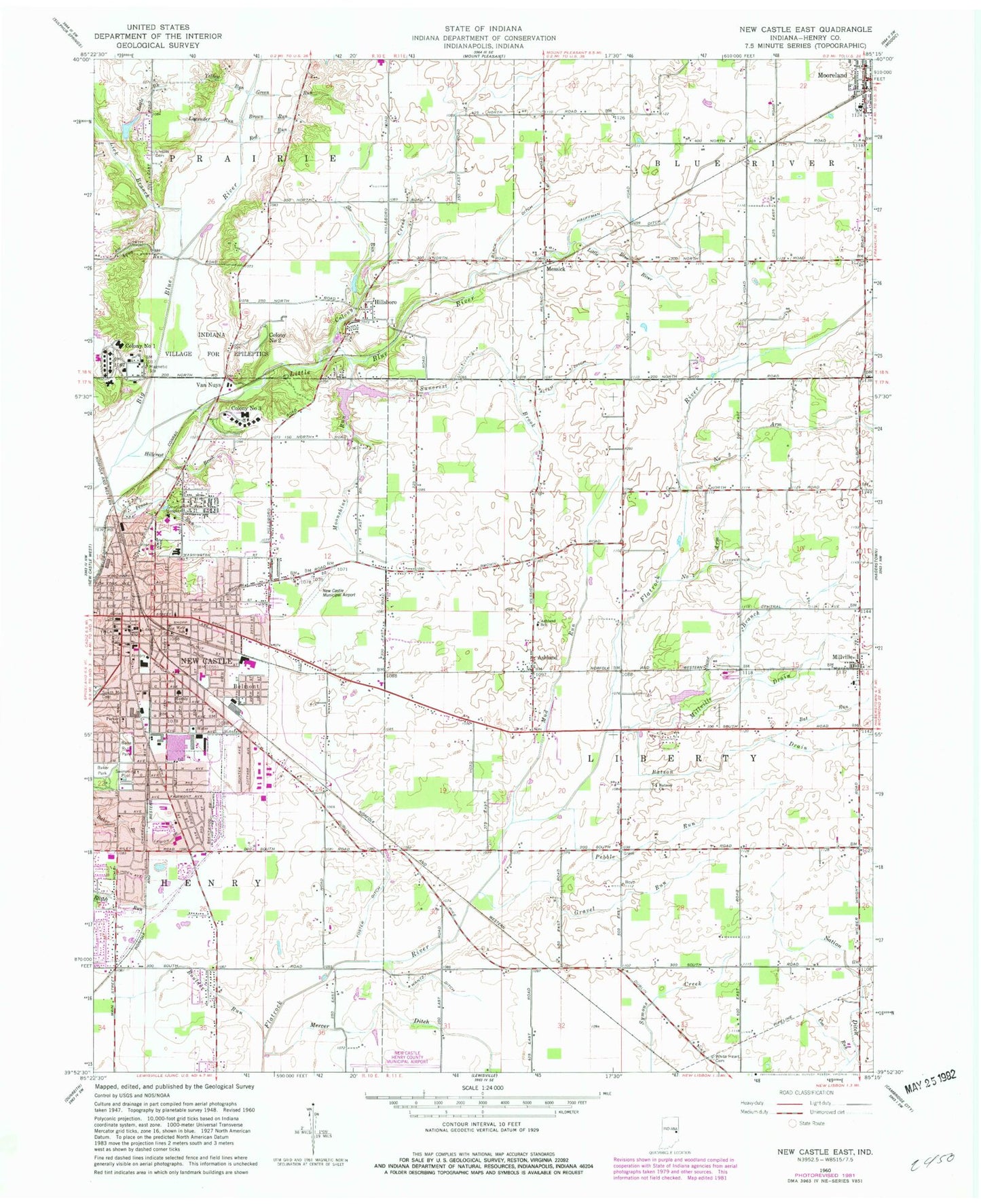
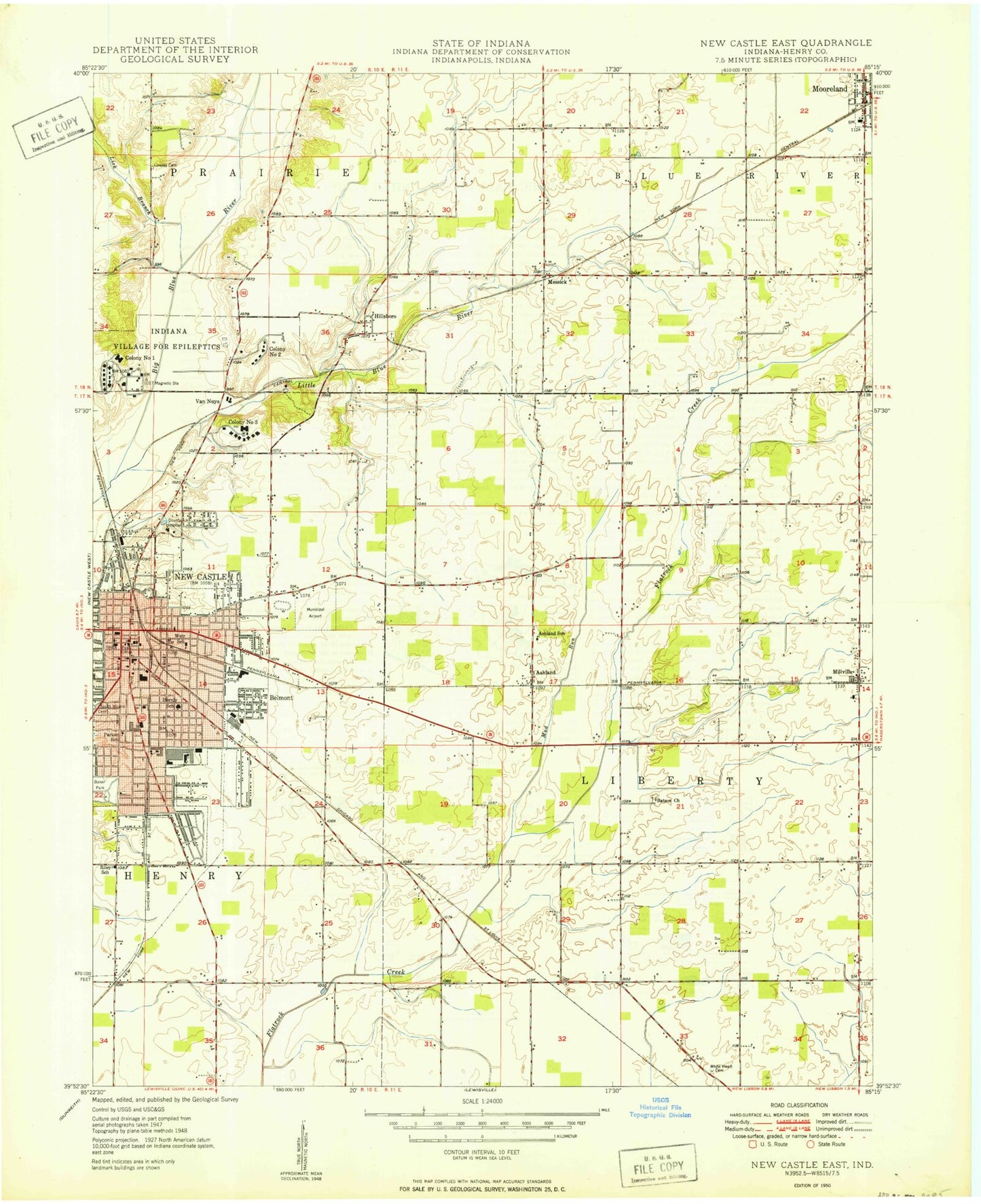
MyTopo
Classic USGS New Castle East Indiana 7.5'x7.5' Topo Map
Couldn't load pickup availability
Historical USGS topographic quad map of New Castle East in the state of Indiana. Map scale may vary for some years, but is generally around 1:24,000. Print size is approximately 24" x 27"
This quadrangle is in the following counties: Henry.
The map contains contour lines, roads, rivers, towns, and lakes. Printed on high-quality waterproof paper with UV fade-resistant inks, and shipped rolled.
Contains the following named places: Alten Ditch, Aqua Run, Ashland, Ashland School, Babe Ruth Park, Bat Run, Batson Church, Batson Drain, Battle Brook, Belmont, Black Ditch, Blue River Township Fire Department, Boulder Run, Brown Run, City of New Castle, Colony Creek, Coo Run, Corwin, Foster Ditch, Gravel Run, Green Run, Hauffman Ditch, Henry Community Health, Henry County Sheriff Department Emergency Medical Service, Henry County Sheriff's Office, Hernly School, Hillcrest Brook, Hillsboro, Indiana Village for Epileptics, James Whitcomb Riley Elementary School, Kessinger Cemetery, Lavender Run, Lick Branch, Little Blue River, Livezey Cemetery, Mercer Ditch, Messick, Millville, Millville - Liberty Township Fire Department, Millville Drain, Moonshine Run, Mooreland, Mooreland Police Department, Mooreland Post Office, Mooreland Volunteer Fire Department, Mud Run, Nation Ditch, New Castle, New Castle Correctional Facility, New Castle Emergency Medical Service, New Castle Fire Department Station 1, New Castle Fire Department Station 2, New Castle Fire Department Station 3, New Castle Municipal Airport, New Castle Police Department, New Castle Post Office, New Castle State Developmental Center, Number One Arm, Number Two Arm, Parker Elementary School, Pebble Run, Penns Run, Pierson Station, Red Run, Slo Run, Stone Branch, Suncrest Brook, Town of Mooreland, Township of Blue River, Township of Liberty, Upper Big Blue River Structure Number 15, Van Nuys, Wantz Ditch, Weir School, White Heart Cemetery, White Jersey Farm, Wilbur Wright Elementary School, Yellow Run, ZIP Code: 47362