MyTopo
Classic USGS New Castle West Indiana 7.5'x7.5' Topo Map
Couldn't load pickup availability
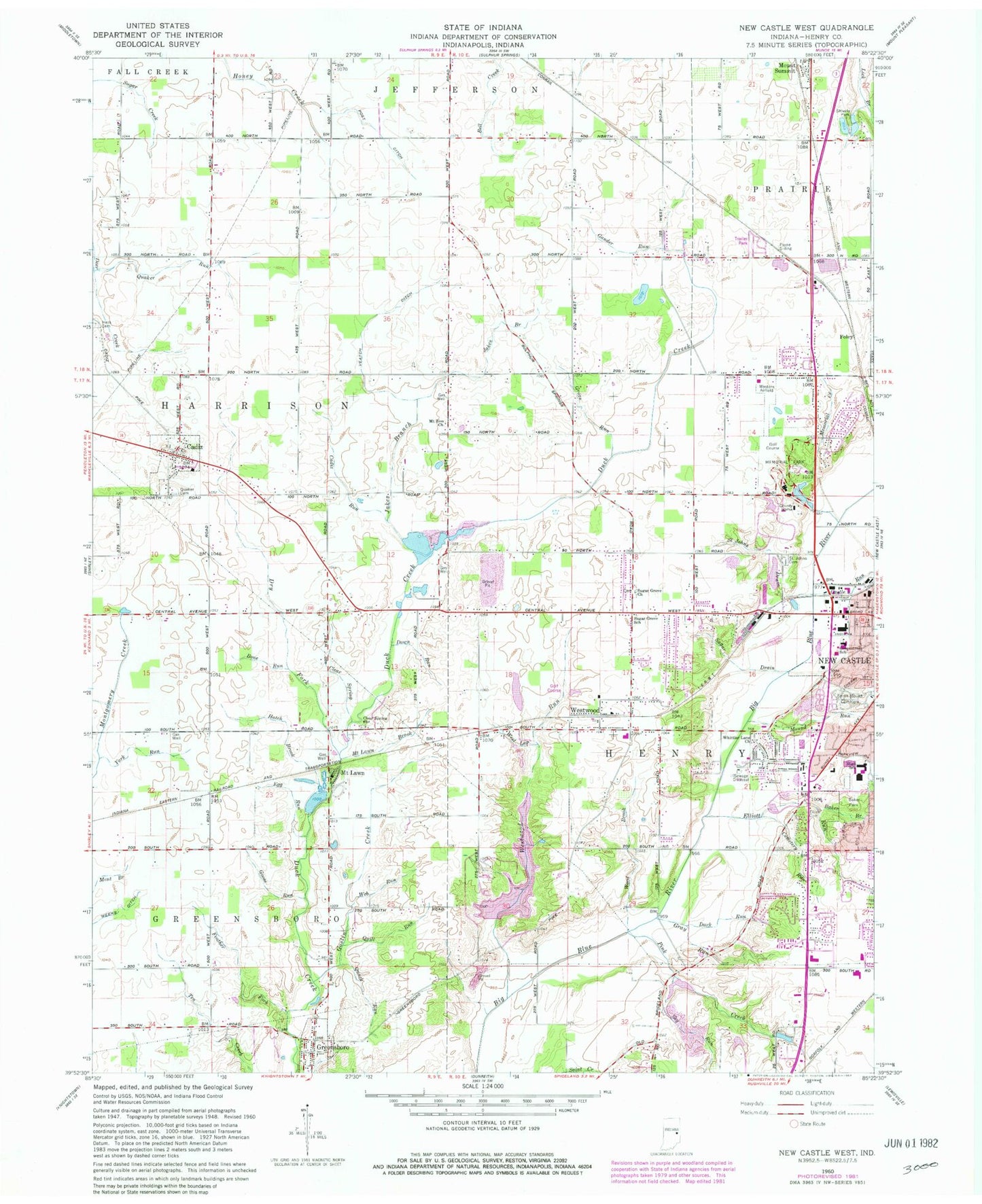
Historical USGS topographic quad map of New Castle West in the state of Indiana. Map scale may vary for some years, but is generally around 1:24,000. Print size is approximately 24" x 27"
This quadrangle is in the following counties: Henry.
The map contains contour lines, roads, rivers, towns, and lakes. Printed on high-quality waterproof paper with UV fade-resistant inks, and shipped rolled.
Contains the following named places: Baker Branch, Baker Park, Bone Run, Cadiz, Cadiz - Harrison Township Volunteer Fire Department, Cadiz Friends Cemetery, Cadiz Run, Castle Run, Clear Spring, Clear Spring Church, Dark Run, Down Run, Dry Fork, Egg Run, Elliott Cemetery, Elliott Cemetery Run, Elliott Run, Fayne Siding, Feather Fork, Ferrell Airport, Foley, Gander Run, Giboney Lake, Giboney Lake Dam, Goose Run, Goslin Creek, Greensboro, Greensboro Post Office, Greensboro Volunteer Fire Department, Greenstreet Elementary School, Grove Run, Hatch Brook, Henry County, Hess Cemetery, Jakes Branch, Memorial Creek, Memorial Park, Mound Run, Mount Lawn, Mount Lawn Brook, Mount Zion Church, New Castle Chrysler High School, Parkview Junior High B-7 Building, Parkview Junior High School, Pink Creek, Post Ditch, Quack Run, Quaker Run, Quill Run, Saint Annes Catholic Cemetery, Saint Creek, Saint Johns Drain, Shively Park, Sky Run, South Mound Cemetery, Sugar Drain, Sugar Grove Church, Sugar Grove School, Town of Cadiz, Town of Greensboro, Town of Sulphur Springs, Township of Henry, Upper Big Blue Structure Number 14, Veatch Ditch, WCTW-AM (New Castle), Web Run, West Leg Westwood Run, Westwood, Westwood Park Reservoir, Westwood Run, Whittier Lane Church, Wood Brook, York Run, ZIP Code: 47344