MyTopo
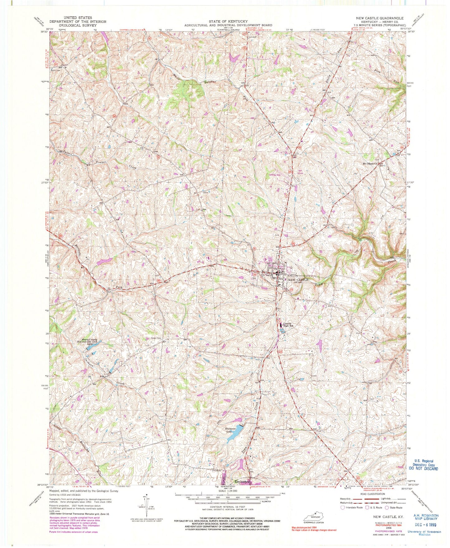
Classic USGS New Castle Kentucky 7.5'x7.5' Topo Map
Couldn't load pickup availability
Historical USGS topographic quad map of New Castle in the state of Kentucky. Map scale may vary for some years, but is generally around 1:24,000. Print size is approximately 24" x 27"
This quadrangle is in the following counties: Henry.
The map contains contour lines, roads, rivers, towns, and lakes. Printed on high-quality waterproof paper with UV fade-resistant inks, and shipped rolled.
Contains the following named places: Bruce Family Cemetery, Chinn - Elley - Dupuy - Smith Cemetery, City of New Castle, Deer Run Airpark, Eminence Lake, Henry County Church, Henry County Emergency Medical Services, Henry County Poor House, Henry County Rod and Gun Club Lake, Henry County Sheriff's Office, Hillsboro Baptist Church, Hillsboro School, Hughley Cemetery, John M Foree Airport, Logan Cemetery, Mount Gilead Church, Mount Gilead School, New Castle, New Castle Division, New Castle Fire Department, New Castle Police Department, New Castle Post Office, Russell School, Sanford School, Simmons Bridge, Webb Cemetery, White Sulphur School, ZIP Codes: 40019, 40050, 40058, 40070