MyTopo
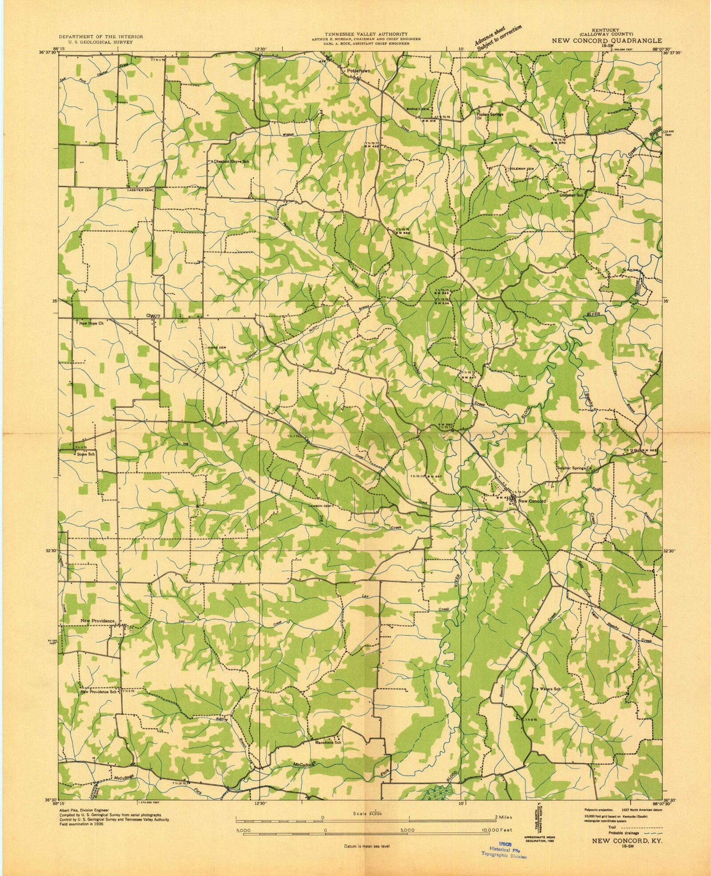
Classic USGS New Concord Kentucky 7.5'x7.5' Topo Map
Couldn't load pickup availability
Historical USGS topographic quad map of New Concord in the state of Kentucky. Map scale may vary for some years, but is generally around 1:24,000. Print size is approximately 24" x 27"
This quadrangle is in the following counties: Calloway.
The map contains contour lines, roads, rivers, towns, and lakes. Printed on high-quality waterproof paper with UV fade-resistant inks, and shipped rolled.
Contains the following named places: Barnett Cemetery, Beechy Creek, Blood River Bottoms, Bullfrog Branch, Bullfrog Hollow, Calloway County Fire and Rescue Station 2, Calloway County Fire and Rescue Station 7, Cherry Corner, Cherry Corner Church, Coleman Branch, Coleman Cemetery, Culpepper Hollow, Devils Pulpit, Dog Creek, East Prong Beechy Creek, Egypt Hollow, Fitts - Dalton Cemetery, Good Shephard Church, Goose Creek, Hicks Cemetery, Knight Branch, Lassiter Cemetery, Lawrence Branch, Lawson Cemetery, Lax Creek, Macedonia, Macedonia Church, McCruiston, McCullough Fork, New Concord, New Concord Cemetery, New Concord Division, New Concord Post Office, New Hope Church, New Providence, Outland Cemetery, Panther Creek, Parker Cemetery, Pleasant Valley Church, Poplar Spring, Poplar Springs Church, Pottertown, Stubblefield Cemetery, Sulphur Springs Church, Tan Branch, Wildcat Creek