MyTopo
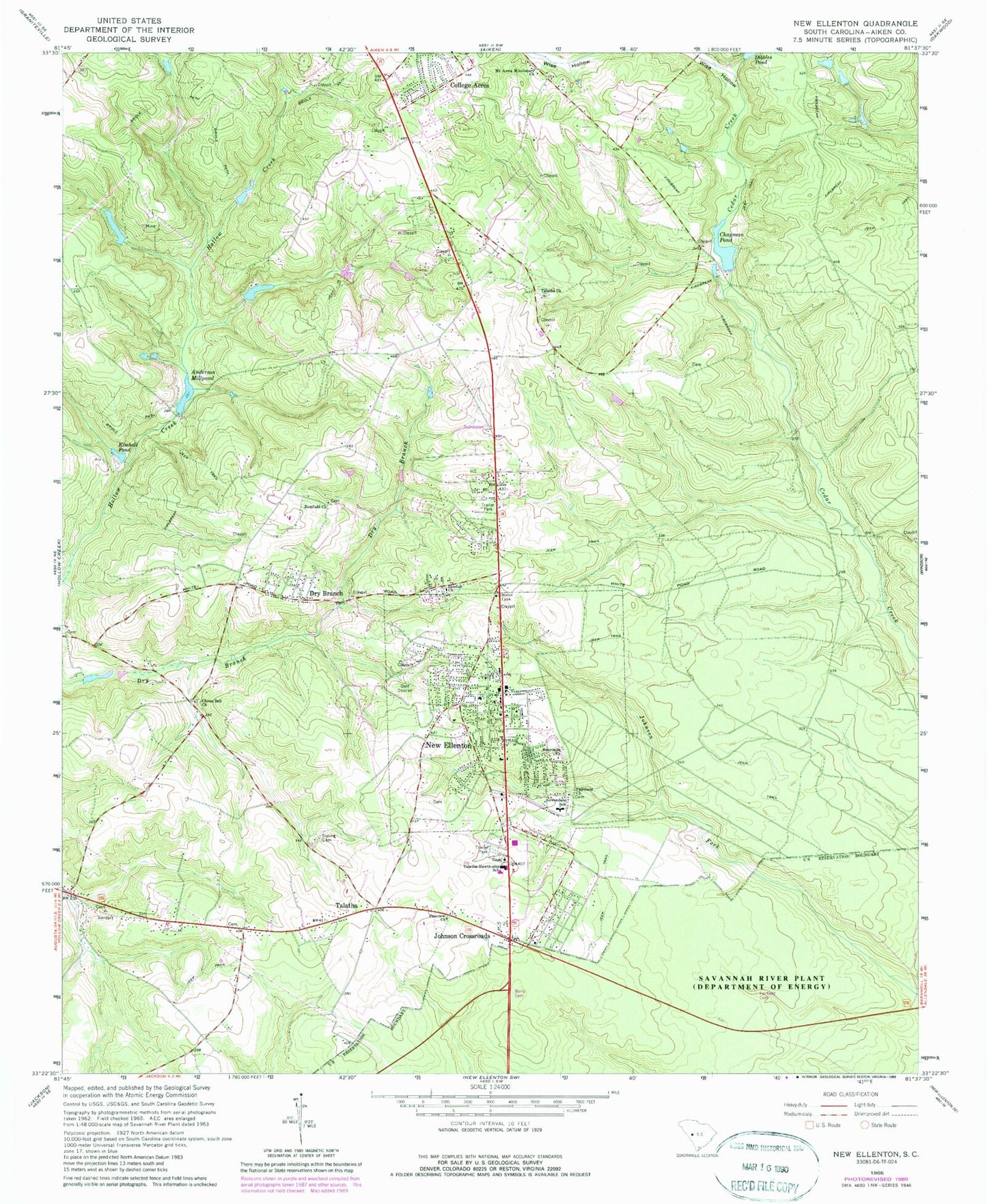
Classic USGS New Ellenton South Carolina 7.5'x7.5' Topo Map
Couldn't load pickup availability
Historical USGS topographic quad map of New Ellenton in the state of South Carolina. Map scale may vary for some years, but is generally around 1:24,000. Print size is approximately 24" x 27"
This quadrangle is in the following counties: Aiken.
The map contains contour lines, roads, rivers, towns, and lakes. Printed on high-quality waterproof paper with UV fade-resistant inks, and shipped rolled.
Contains the following named places: Aiken Public Safety Department Station 5, Aiken Public Safety Station 4, Anderson Millpond, Berry Cemetery, Brookhaven Estates, Burdens Deep Pond, Cedar Creek Church, Cedar Creek School, Cedar Grove Church, Chapman Pond, Chime Bell Baptist Church, Chukker Creek, College Acres, Corinth Baptist Church, Dry Branch, Fair Hill Church, Fairfield Cemetery, Fairfield Church, Fairview School, Foreman Memorial Baptist Church, Four Mile Baptist Church, Greendale School, Gum Ford School, Hitchcock Mill Pond, Holley Lake, Hunters Glen, Johnson Crossroads, Kimball Pond, Mission Church, Mount Anna Baptist Church, Mount Enon Church, New Ellenton, New Ellenton Country Club, New Ellenton Division, New Ellenton Fire Department, New Ellenton Police Department, New Ellenton Post Office, Oak Hill, Pineview Church, Saint Paul United Methodist Church, South Carolina Noname 02018 D-2000 Dam, South Carolina Noname 02026 D-2004 Dam, South Carolina Noname 02111 D-2049 Dam, Southlawn Cemetery and Mausoleum, Spring Cemetery, Spring Church, Talatha, Talatha Baptist Church, Talatha Church, Talatha Farms, Talatha School, Talatha-Hawthorne School, Town of New Ellenton, Williamson Lake, Williamson Lake Dam D-2050, Wise Hollow, Zion Fair Baptist Church, Zion Field Baptist Church, ZIP Code: 29809


