MyTopo
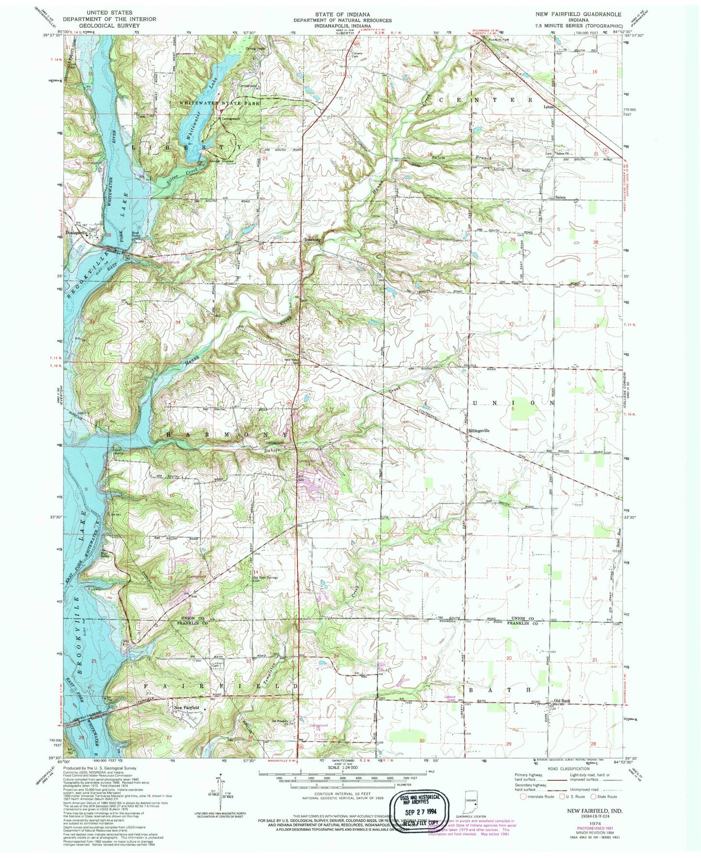
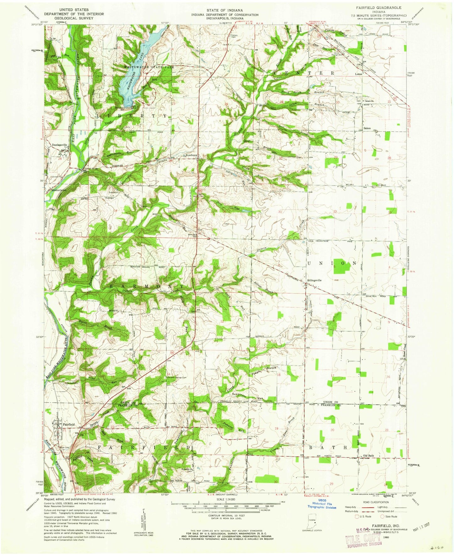
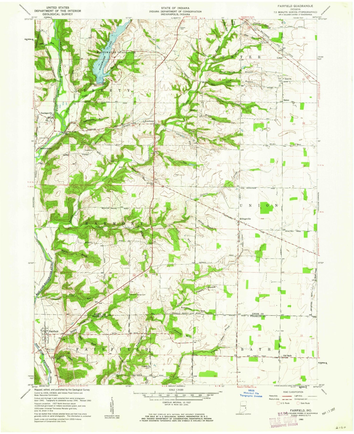
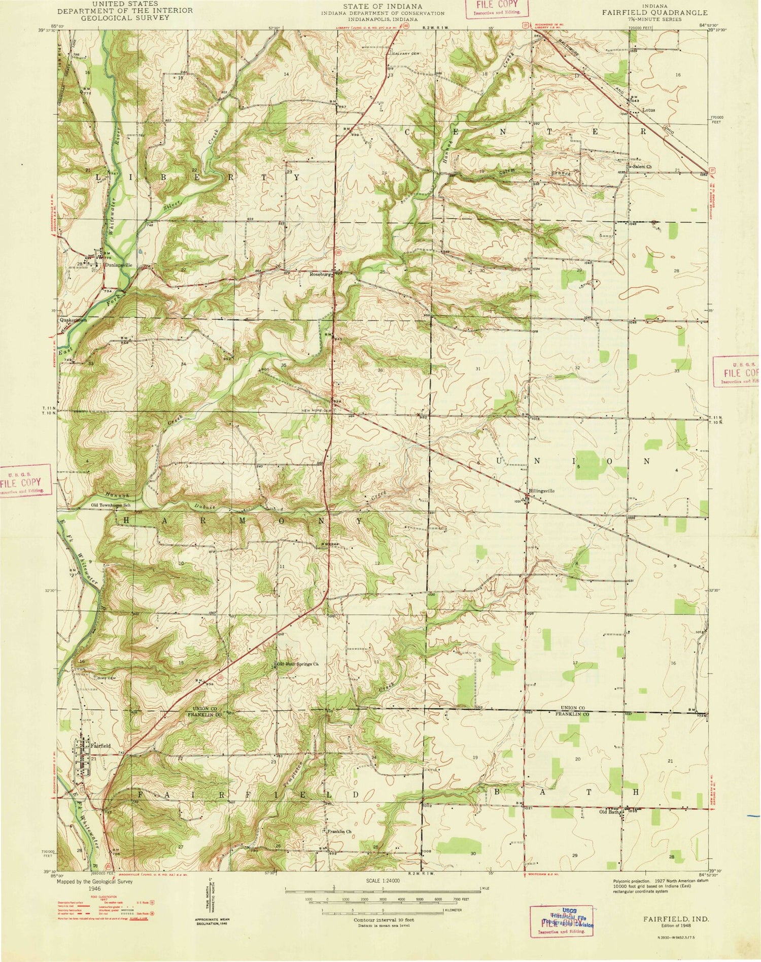
Classic USGS New Fairfield Indiana 7.5'x7.5' Topo Map
Couldn't load pickup availability
Historical USGS topographic quad map of New Fairfield in the state of Indiana. Typical map scale is 1:24,000, but may vary for certain years, if available. Print size: 24" x 27"
This quadrangle is in the following counties: Franklin, Union.
The map contains contour lines, roads, rivers, towns, and lakes. Printed on high-quality waterproof paper with UV fade-resistant inks, and shipped rolled.
Contains the following named places: Billingsville, Brookville Lake, Calvary Cemetery, Dubois Creek, Dunlapsville, Lotus, New Fairfield, New Hope Cemetery, Old Bath, Bath Springs Cemetery, Old Franklin Church, Roseburg, Salem, Salem Branch, Salem Church, Silver Creek, Whitewater Lake, Whitewater State Park, Whitewater State Park Lake Dam, Bath Creek, Blue Lick, Fairfield, Dunlapsville Causeway, Fairfield Causeway, Township of Fairfield, Township of Harmony, Township of Liberty, Billingsville, Brookville Lake, Calvary Cemetery, Dubois Creek, Dunlapsville, Lotus, New Fairfield, New Hope Cemetery, Old Bath, Bath Springs Cemetery, Old Franklin Church, Roseburg, Salem, Salem Branch, Salem Church, Silver Creek, Whitewater Lake, Whitewater State Park, Whitewater State Park Lake Dam, Bath Creek, Blue Lick, Fairfield, Dunlapsville Causeway, Fairfield Causeway, Township of Fairfield, Township of Harmony, Township of Liberty