MyTopo
Classic USGS New Fork Lakes Wyoming 7.5'x7.5' Topo Map
Couldn't load pickup availability
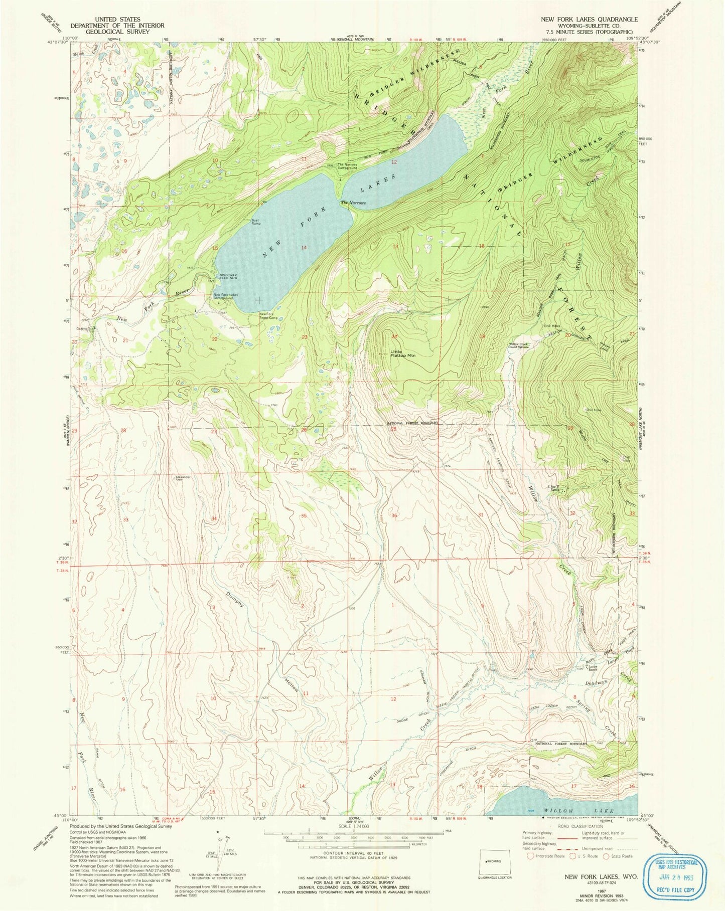
Historical USGS topographic quad map of New Fork Lakes in the state of Wyoming. Typical map scale is 1:24,000, but may vary for certain years, if available. Print size: 24" x 27"
This quadrangle is in the following counties: Sublette.
The map contains contour lines, roads, rivers, towns, and lakes. Printed on high-quality waterproof paper with UV fade-resistant inks, and shipped rolled.
Contains the following named places: New York Campground, Deadman Creek, Dodge Ditch, Dumphy Hollow, Graham Ditch, Josephine Ditch, Little Flattop Mountain, Lizzie Lozier Ditch, Lizzie Lozier North Ditch, Lowline Trail, Lozier Creek, Lozier Ranch, New Fork Canyon Trail, New Fork Lakes, New Fork Lakes Campground, New Fork Scout Camp, Spring Creek, The Narrows, The Narrows Campground, Willow Creek Guard Station, Z Bar U Ranch, New Fork Lake Dam, New Fork Lake