MyTopo
Classic USGS New Franklin Missouri 7.5'x7.5' Topo Map
Couldn't load pickup availability
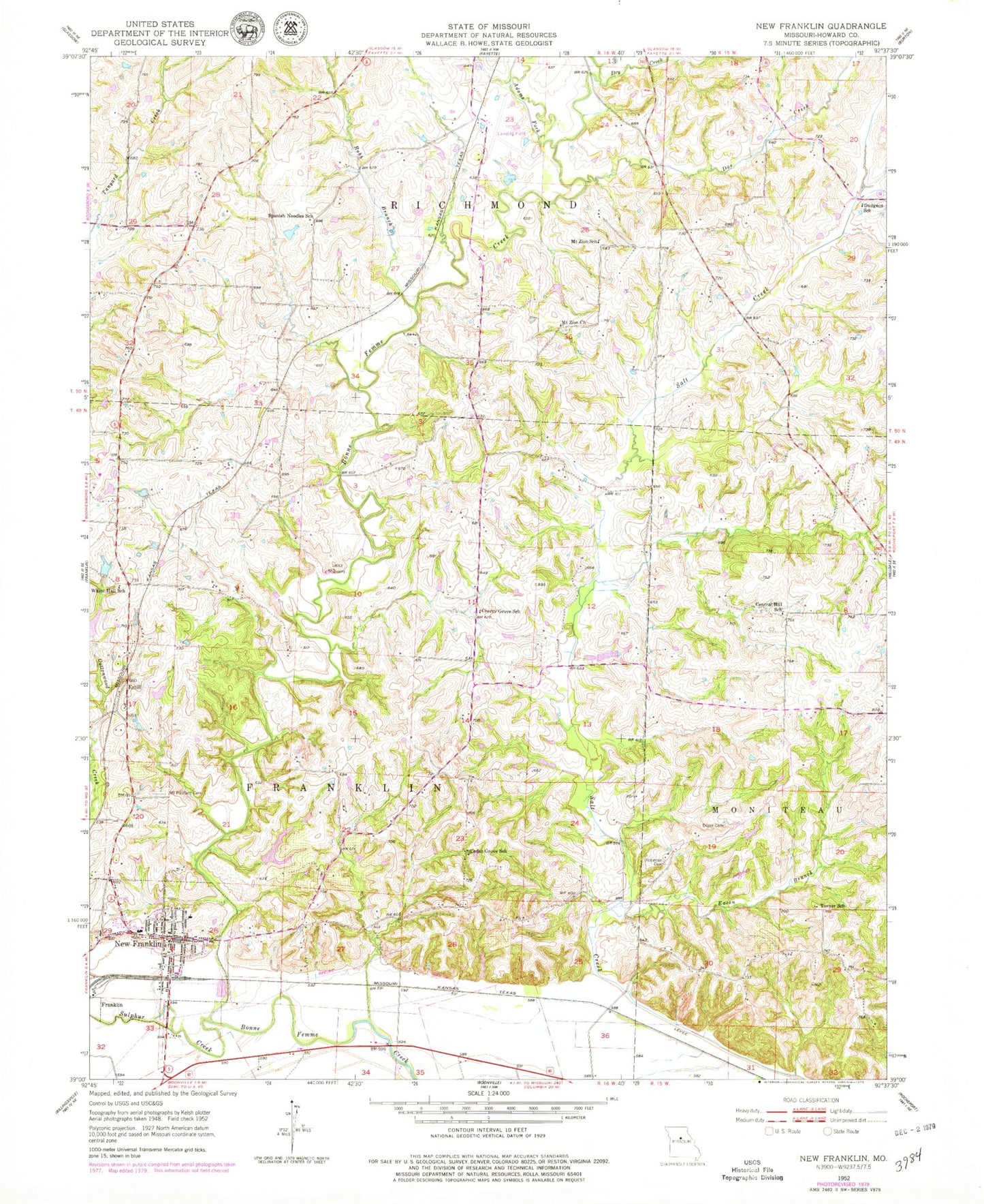
Historical USGS topographic quad map of New Franklin in the state of Missouri. Map scale may vary for some years, but is generally around 1:24,000. Print size is approximately 24" x 27"
This quadrangle is in the following counties: Howard.
The map contains contour lines, roads, rivers, towns, and lakes. Printed on high-quality waterproof paper with UV fade-resistant inks, and shipped rolled.
Contains the following named places: Adams Fork, Boonslick, Buckharts, Cedar Grove School, Central Hill School, Cherry Grove School, City of New Franklin, Davis Lake Dam, Doe Creek, Drake - Campbell Cemetery, Dry Creek, Dudgeon School, Eaton Branch, Estill, Fayette Flying Field, Gray School, Howell Lake Dam, Mount Pleasant Cemetery, Mount Zion Church, Mount Zion School, New Franklin, New Franklin Elementary School, New Franklin Fire Department Howard County Fire Protection District Station 2, New Franklin High School, New Franklin Police Department, New Franklin Post Office, Robb Branch, Robinson Cemetery, Rosalee, Spanish Needles School, Sulphur Creek, Talbot, Township of Franklin, Turner School, White Hall School, ZIP Code: 65274