MyTopo
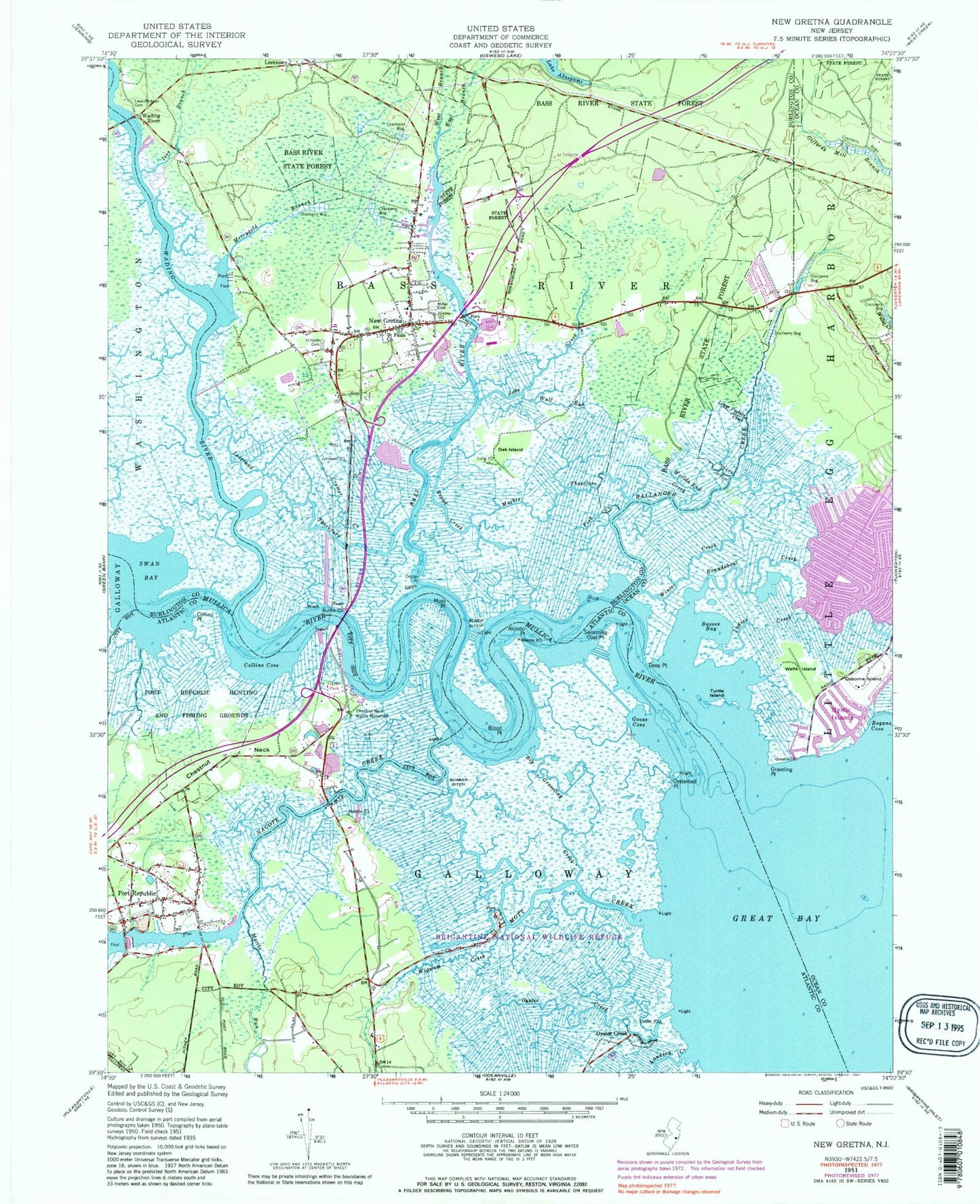
Classic USGS New Gretna New Jersey 7.5'x7.5' Topo Map
Couldn't load pickup availability
Historical USGS topographic quad map of New Gretna in the state of New Jersey. Map scale may vary for some years, but is generally around 1:24,000. Print size is approximately 24" x 27"
This quadrangle is in the following counties: Atlantic, Burlington, Ocean.
The map contains contour lines, roads, rivers, towns, and lakes. Printed on high-quality waterproof paper with UV fade-resistant inks, and shipped rolled.
Contains the following named places: Adams - Leek - McKeen Cemetery, Akimbo Point, Ballinger Creek, Bass River, Bass River Neck, Bass River Township Elementary School, Basses Bay, Big Creek, Big Graveling Creek, Blood Ditch, Blood Point, Bogans Cove, Brigantine National Wildlife Refuge, Brigantine Wilderness, Broad Creek, Bubs Creek, Chestnut Neck, Chestnut Neck Battle Monument, City of Port Republic, Collins Cove, Collins Point, Cramer Creek, Deep Point, Doctors Point, East Branch Bass River, First Presbyterian Church, Fish Creek, Goose Cove, Graveling Point, Great Bay, Higbeeville, Hillside Cemetery, Ives Branch, Jobs Creek, Johnsontown, Judies Creek, Landing Creek, Leektown, Loveland Thorofare, Lower Pasture Creek, Mathis Thorofare, Mattix Run, Merrygold, Merrygold Branch, Miller Cemetery, Moss Point, Mott Creek, Mullica River, Mystic Island, Mystic Island Census Designated Place, Nacote Creek, New Gretna, New Gretna Census Designated Place, New Gretna Post Office, New Gretna Volunteer Fire Company, New Jersey State Police Troop E Bass River Station, Oak Island, Osborne Island, Oyster Creek, Oysterbed Point, Pollys Ditch, Port Republic, Port Republic Elementary School, Port Republic Volunteer Fire Company, Port Republic Wildlife Management Area, Quaker Ditch, Roundabout Creek, Saint Pauls Methodist Church, Saint Pauls United Methodist Church, Swan Bay, Swimming Over Point, Turtle Island, Wading River, Wells Island, West Branch Bass River, Wigwam Creek, Winter Creek, Wolf Run, Worlds End Creek, ZIP Codes: 08087, 08224, 08241