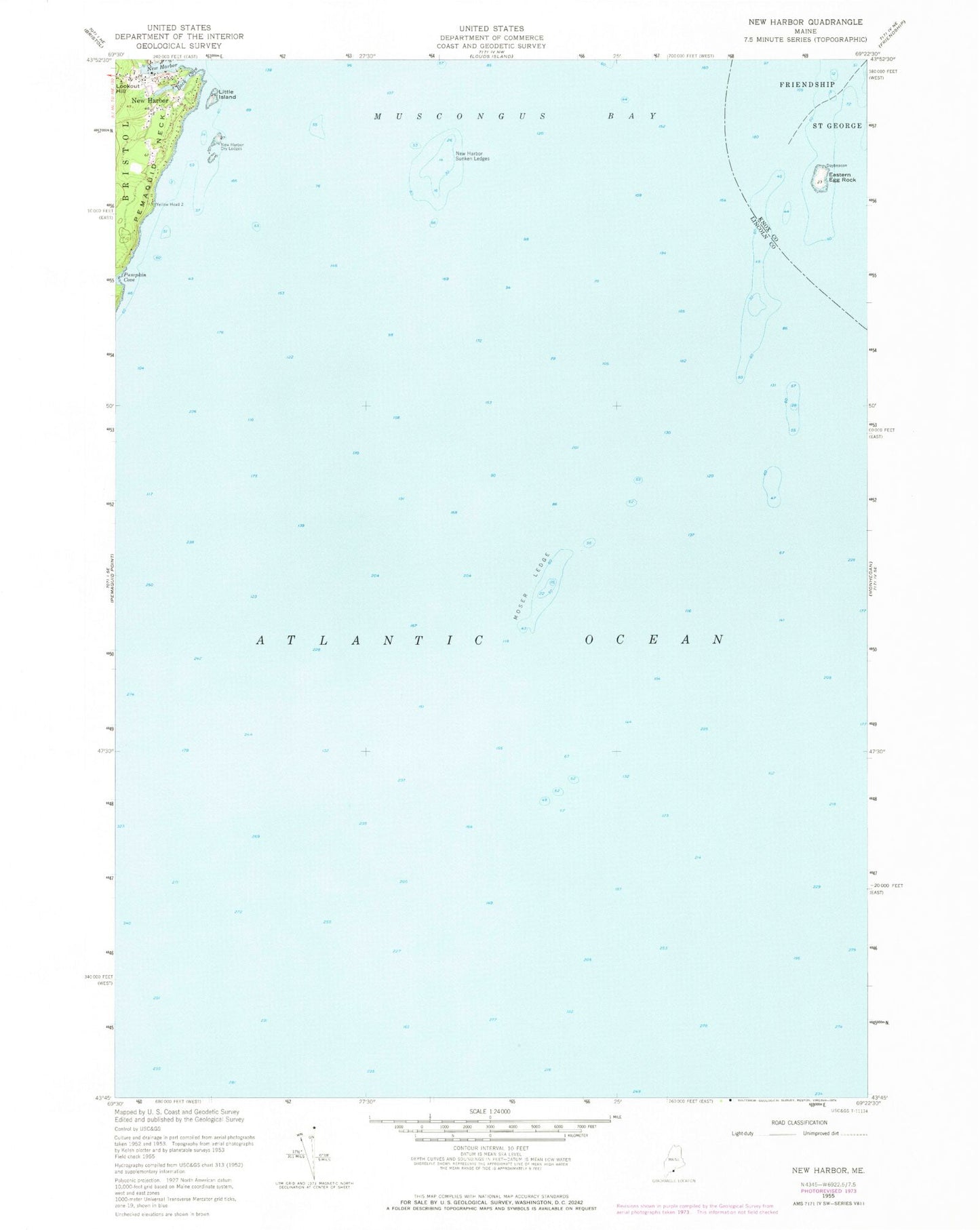
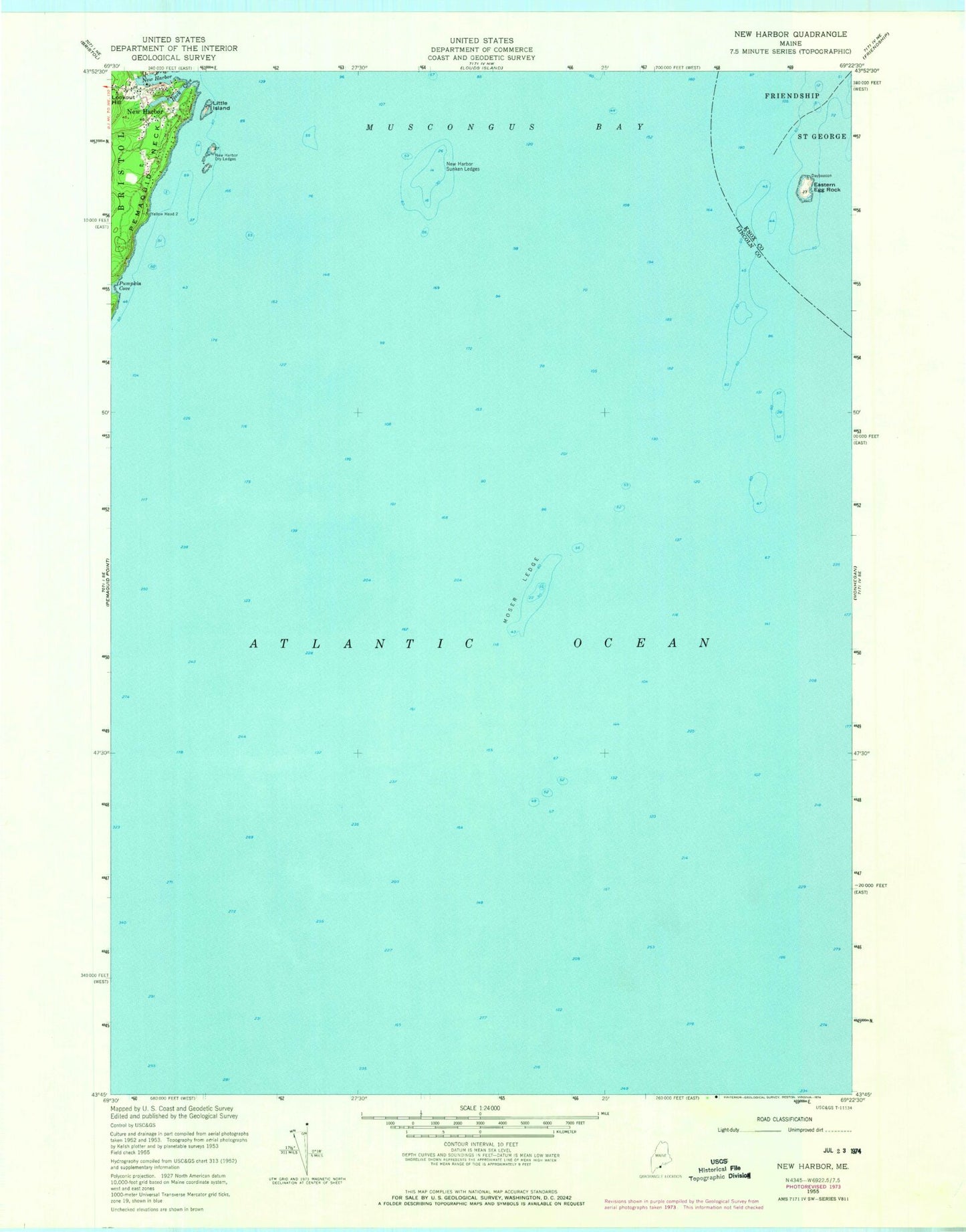
MyTopo
Classic USGS New Harbor Maine 7.5'x7.5' Topo Map
Regular price
$16.95
Regular price
Sale price
$16.95
Unit price
per
Couldn't load pickup availability
Historical USGS topographic quad map of New Harbor in the state of Maine. Map scale may vary for some years, but is generally around 1:24,000. Print size is approximately 24" x 27"
This quadrangle is in the following counties: Knox, Lincoln.
The map contains contour lines, roads, rivers, towns, and lakes. Printed on high-quality waterproof paper with UV fade-resistant inks, and shipped rolled.
Contains the following named places: Back Cove, Eastern Egg Rock, Egg Rock North Ledge, Egg Rock South Ledge, Little Island, Moser Ledge, New Harbor, New Harbor Dry Ledges, New Harbor Sunken Ledges, Pumpkin Cove, Pumpkin Cove Ledge, Samoset Memorial, Shaws Wharf, South Ledge, Yellow Head