
MyTopo
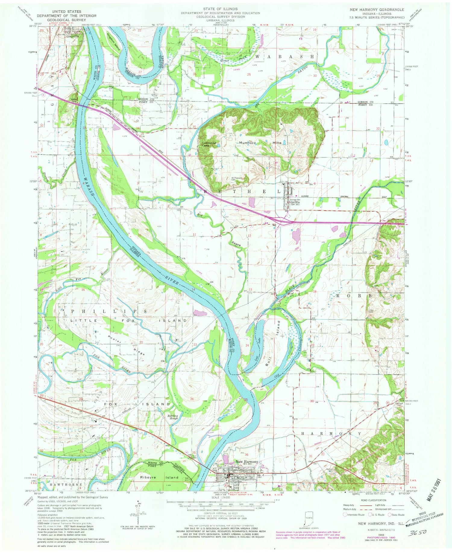
Classic USGS New Harmony Indiana 7.5'x7.5' Topo Map
Couldn't load pickup availability
Historical USGS topographic quad map of New Harmony in the states of Indiana, Illinois. Map scale may vary for some years, but is generally around 1:24,000. Print size is approximately 24" x 27"
This quadrangle is in the following counties: Gibson, Posey, Wabash, White.
The map contains contour lines, roads, rivers, towns, and lakes. Printed on high-quality waterproof paper with UV fade-resistant inks, and shipped rolled.
Contains the following named places: Allen Cemetery, Big Bayou, Black River, Bull Island, Continental Camp, Cox Creek, Fox Island, French Creek, Goose Pond, Griffin, Griffin - Bethel Volunteer Fire Department, Griffin Post Office, Harmony Creek, Kingdom Island, Little Fox Island, Little Fox River, Lost Lake, Mount Pleasant Cemetery, Mumford Hills, Murphy Run, New Baltimore, New Harmony, New Harmony Bridge, New Harmony Post Office, New Harmony Town Marshal, New Harmony Volunteer Fire Department, Old Channel, Old Channel Wabash River, Pelham Cemetery, Poplar Ridge, Rattling Slough, Stillwell Cemetery, Town of Griffin, Town of New Harmony, Township of Bethel, Webbs Ferry, ZIP Code: 47616


