MyTopo
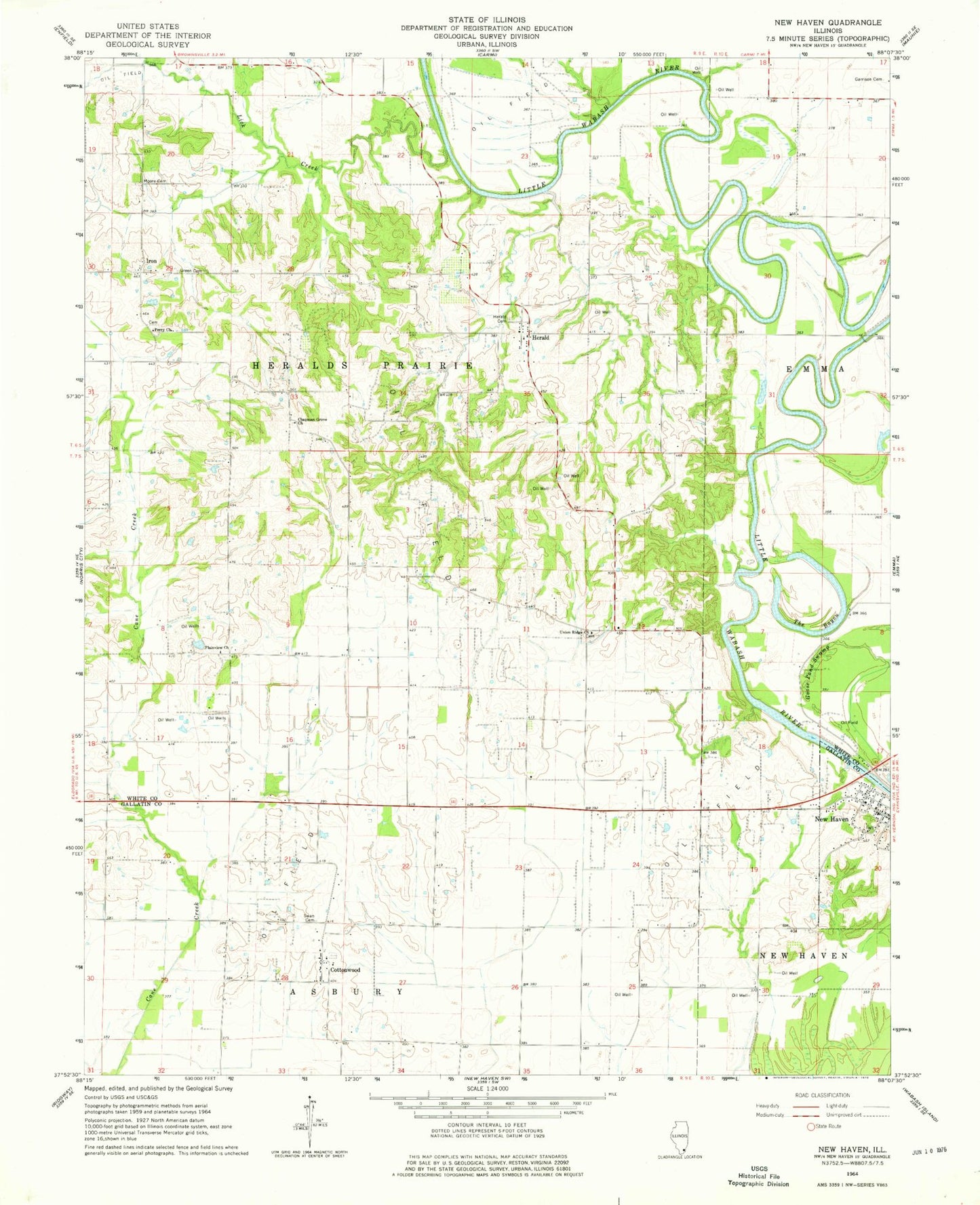
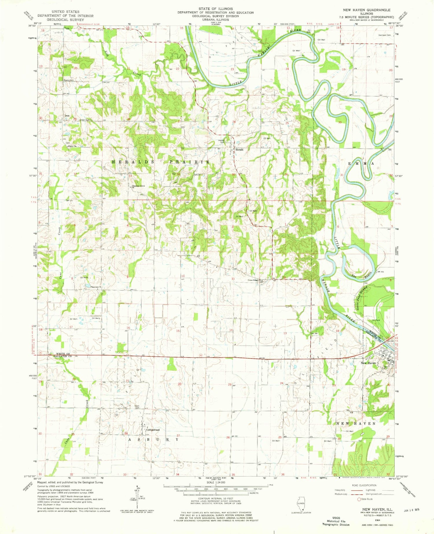
Classic USGS New Haven Illinois 7.5'x7.5' Topo Map
Couldn't load pickup availability
Historical USGS topographic quad map of New Haven in the state of Illinois. Map scale may vary for some years, but is generally around 1:24,000. Print size is approximately 24" x 27"
This quadrangle is in the following counties: Gallatin, White.
The map contains contour lines, roads, rivers, towns, and lakes. Printed on high-quality waterproof paper with UV fade-resistant inks, and shipped rolled.
Contains the following named places: Chapman Grove Church, Cottonwood, Garrison Family Cemetery, Goose Pond Swamp, Green Cemetery, Herald, Herald Cemetery, Iron, Lick Creek, Moore Cemetery, New Haven, New Haven Fire Department, New Haven Post Office, Oak Grove Cemetery, Perry Church, Plainview Cemetery, Plainview Church, Sutton Airport, Swan Cemetery, The Bayou, Township of Asbury, Township of Heralds Prairie, Union Ridge Cemetery, Union Ridge Church, Village of New Haven, Winners Bend