MyTopo
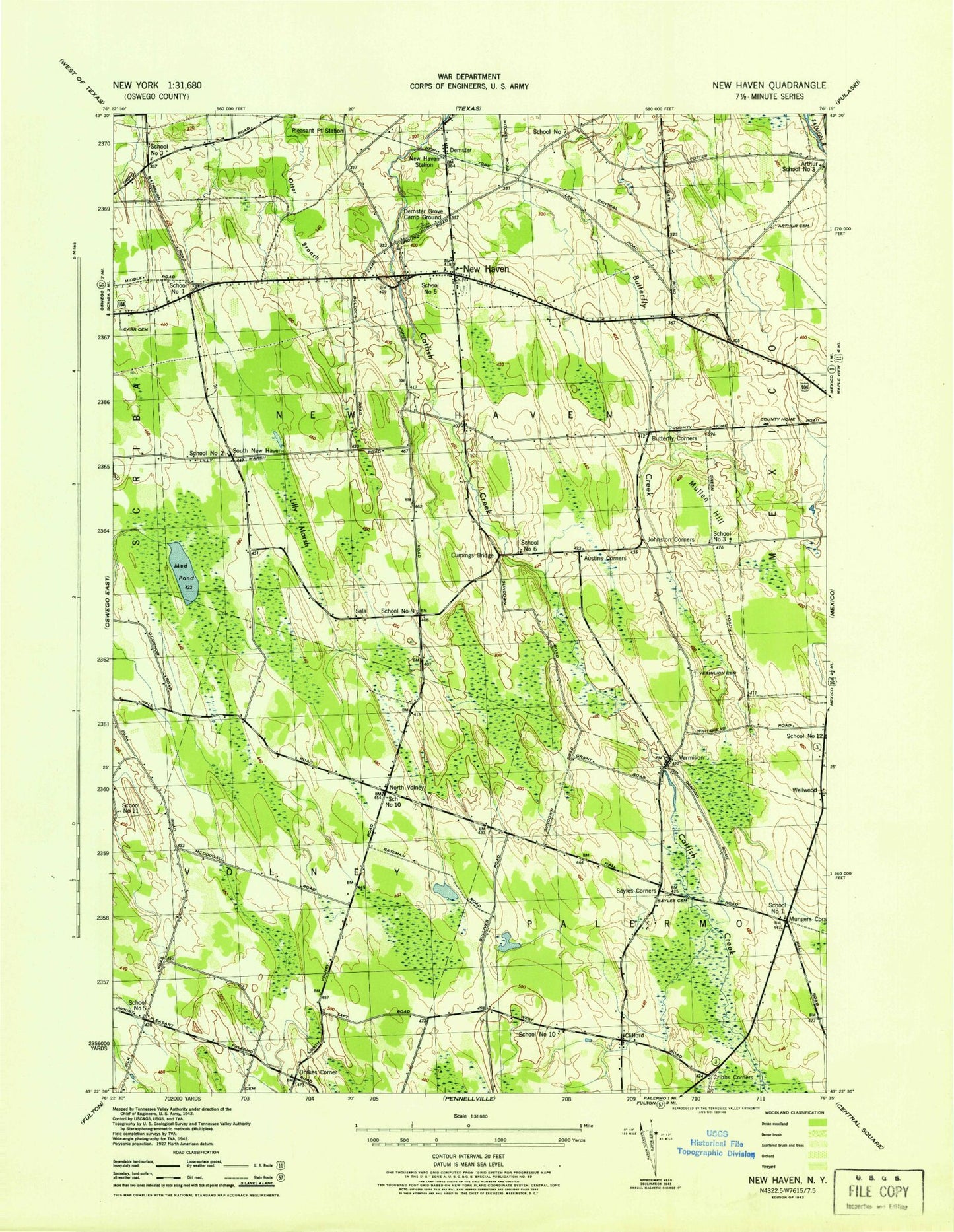
Classic USGS New Haven New York 7.5'x7.5' Topo Map
Couldn't load pickup availability
Historical USGS topographic quad map of New Haven in the state of New York. Map scale may vary for some years, but is generally around 1:24,000. Print size is approximately 24" x 27"
This quadrangle is in the following counties: Oswego.
The map contains contour lines, roads, rivers, towns, and lakes. Printed on high-quality waterproof paper with UV fade-resistant inks, and shipped rolled.
Contains the following named places: Arthur Cemetery, Austins Corners, Behling Orchards, Butterfly Cemetery, Butterfly Corners, Clifford, Clifford Cemetery, Community Alliance Church, Cribbs Corner, Cummings Bridge, Demster, Demster Grove Camp Ground, Drakes Corner, First Congregational Church, Jacobson Farms, Johnson Corners, Lily Marsh, Lily Pond, Maple Help Stock Farms, Mud Pond, Mullen Hill, Mungers Corners, New Haven, New Haven Elementary School, New Haven Post Office, New Haven Rural Cemetery, New Haven Station, New Haven United Methodist Church, New Haven Volunteer Fire Department, North Volney, North Volney Cemetery, Pleasant Point Crossing, Sala, Sayles Corners, Sayles Corners Cemetery, School Number 1, School Number 10, School Number 11, School Number 2, School Number 3, School Number 5, School Number 6, School Number 7, School Number 9, South New Haven, Town of New Haven, Vermilion, Vermilion Cemetery, Wellwood