MyTopo
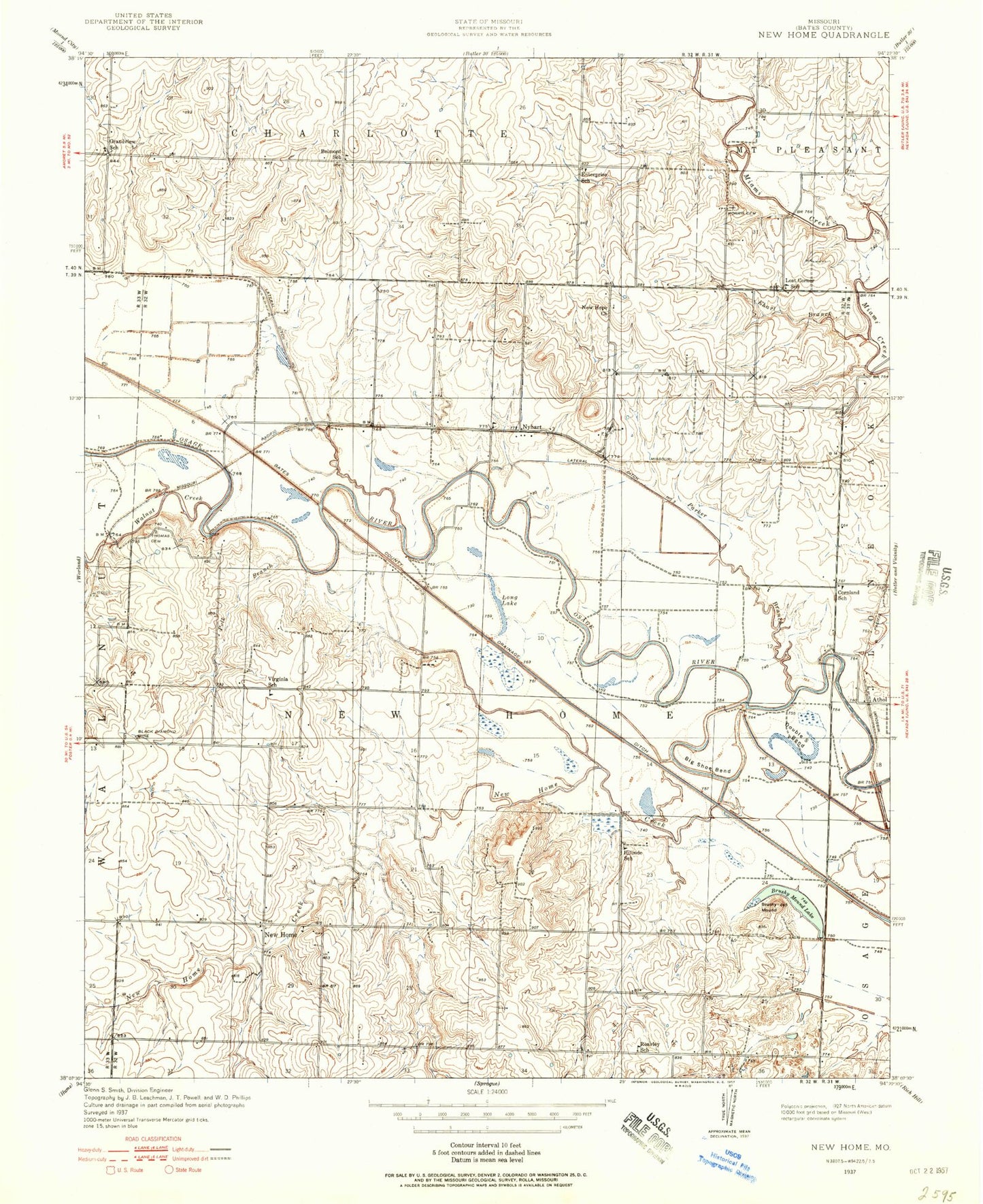
Classic USGS New Home Missouri 7.5'x7.5' Topo Map
Couldn't load pickup availability
Historical USGS topographic quad map of New Home in the state of Missouri. Map scale may vary for some years, but is generally around 1:24,000. Print size is approximately 24" x 27"
This quadrangle is in the following counties: Bates.
The map contains contour lines, roads, rivers, towns, and lakes. Printed on high-quality waterproof paper with UV fade-resistant inks, and shipped rolled.
Contains the following named places: Athol, Belmont School, Big Shoe Bend, Black Diamond Mine, Brushy Mound, Brushy Mound Lake, Cornland, Cornland School, Double S Bend, Ehart Branch, Enterprise School, Grandview School, Hillside School, Lateral Ditch Number 2, Lateral Ditch Number 3, Lateral Ditch Number Three, Long Lake, Lost Corner School, Morris Cemetery, New Home, New Home Creek, New Home School, New Hope Church, Nyhart, Nyhart School, Oerke Enterprises Airport, Parker Branch, Polk Branch, Reavley School, Thomas Cemetery, Township of New Home, Virginia School, Walnut Creek, ZIP Code: 64745