MyTopo
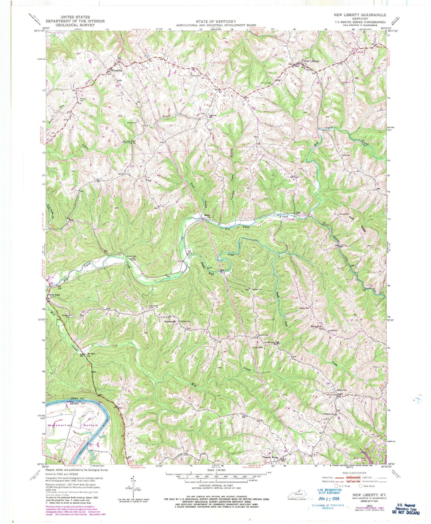
Classic USGS New Liberty Kentucky 7.5'x7.5' Topo Map
Couldn't load pickup availability
Historical USGS topographic quad map of New Liberty in the state of Kentucky. Map scale may vary for some years, but is generally around 1:24,000. Print size is approximately 24" x 27"
This quadrangle is in the following counties: Henry, Owen.
The map contains contour lines, roads, rivers, towns, and lakes. Printed on high-quality waterproof paper with UV fade-resistant inks, and shipped rolled.
Contains the following named places: Alexander Cemetery, Arnold Cemetery, Barnes Cemetery, Benjamin Hancock Cemetery, Burfort Cemetery, Concord College, Cull, Cull Post Office, Dallasburg Masonic Cemetery, Elmore Cemetery, Estes Cemetery, Frazer Cemetery, Hancock Cemetery, Hensley Cemetery, Kemper Cemetery, Lusby - Kemper Cemetery, Marshall Bottom, Meeks Station, Mount Zion Church, Mount Zion Church Cemetery, Mussel Shoals Landing, New Liberty, New Liberty Baptist Church Cemetery, New Liberty Christian Church Cemetery, New Liberty Division, New Liberty IOOF Cemetery, New Liberty Post Office, New Liberty School, New Liberty Second Baptist Church Cemetery, New Liberty Volunteer Fire Department, Perry Park, Perry Park Post Office, Pink Ridge, Pleasant Home, Pleasant Home Cemetery, Pleasant Home Post Office, Priors Branch, Punchen Camp Branch, Roberts Cemetery, Salem Church, Salem Church Cemetery, School Number Fifty-Seven, School Number Forty-Two, School Number Sixty-Eight, School Number Ten, School Number Twenty-Four, Snodgrass Cemetery, South Fork Church, South Fork Creek, Squiresville, Squiresville Cemetery, Squiresville Post Office, Thomas Cemetery, Thomas Landing, Wallace Cemetery, Wheatley, Wheatley Cemetery, Wheatley Post Office, Wheatley School, White Chapel School, Yancey Cemetery