MyTopo
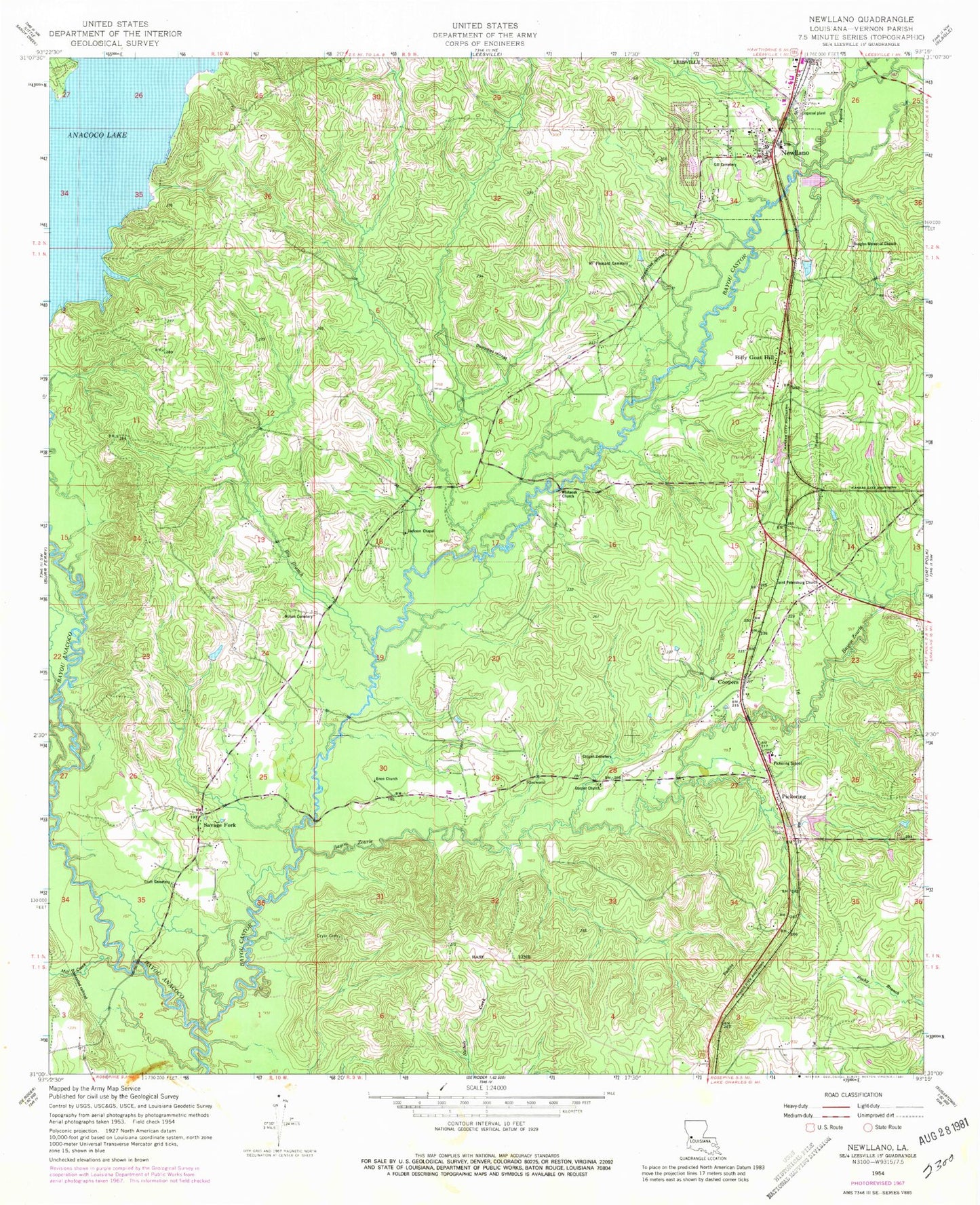
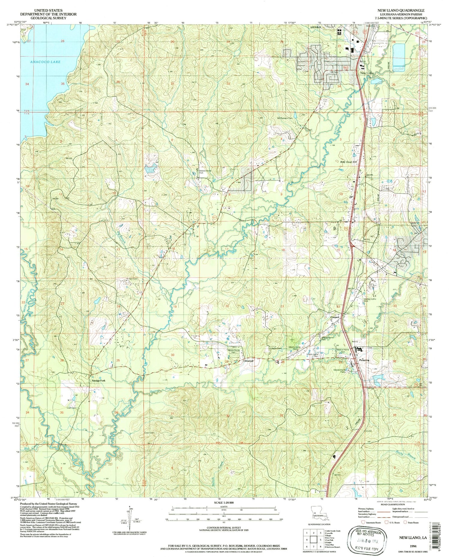
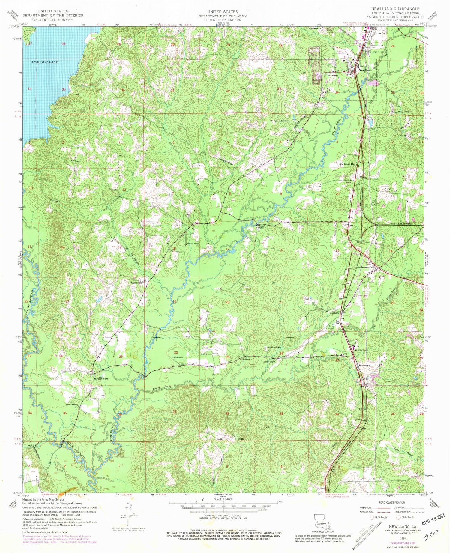
Classic USGS New Llano Louisiana 7.5'x7.5' Topo Map
Couldn't load pickup availability
Historical USGS topographic quad map of New Llano in the state of Louisiana. Map scale may vary for some years, but is generally around 1:24,000. Print size is approximately 24" x 27"
This quadrangle is in the following counties: Vernon.
The map contains contour lines, roads, rivers, towns, and lakes. Printed on high-quality waterproof paper with UV fade-resistant inks, and shipped rolled.
Contains the following named places: Anacoco Lake, Bayou Castor, Bayou Zourie, Big Branch, Billy Goat Hill, Chateau Place, Cooper Baptist Church, Cooper Cemetery, Coopers, Craft Cemetery, Cryer Cemetery, Douglas Memorial Church, Elmwood, Enon Church, First Baptist Church, Gates School, Gill Cemetery, Jackson Chapel Church of God, KCIJ-FM (North Fort Polk), KVVP-FM (Leesville), Leesville Industrial Park, Louisiana Technical College Lamar Salter Campus, Lower Anacoco Dam, Methodist Landing, Mill Creek, Mount Pleasant Cemetery, New Llano, New Llano Fire Department - Station 1, New Llano Police Department, Parish Governing Authority District 8, Pickering, Pickering Elementary School, Pickering High School, Red McManus Camp, Saint Petersburg Church, Savage Fork, Savage Forks Volunteer Fire Association Station 6, Spring Branch, Town of New Llano, Whiteoak Church, Wilson Family Cemetery, Zourie Creek, ZIP Code: 71461