MyTopo
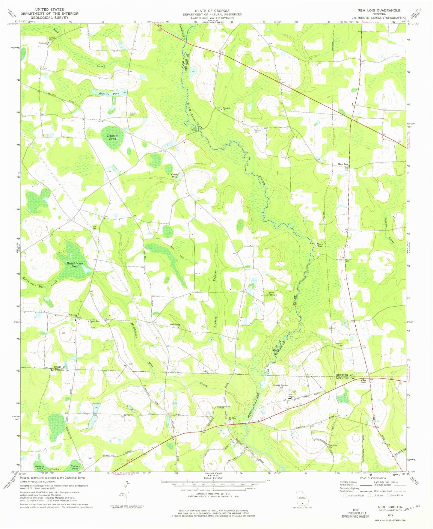
Classic USGS New Lois Georgia 7.5'x7.5' Topo Map
Couldn't load pickup availability
Historical USGS topographic quad map of New Lois in the state of Georgia. Map scale may vary for some years, but is generally around 1:24,000. Print size is approximately 24" x 27"
This quadrangle is in the following counties: Berrien, Cook, Lowndes.
The map contains contour lines, roads, rivers, towns, and lakes. Printed on high-quality waterproof paper with UV fade-resistant inks, and shipped rolled.
Contains the following named places: Baskins Cemetery, Bear Creek, Bemiss Barretts Volunteer Fire Department Station 5A, Boyette Pond, Boyette Pond Dam, Boys Ranch, Camp Tygart, Community Church, County Line Church, Daniels Cemetery, Daniels Pond, Fellowship, Fellowship Church, Futchs Bridge, Futchs Pond, Hagan Bridge, Hutchinson Mill Creek, Hutchinson Pond, Indian Trail Branch, Kings Chapel, Lindsey Branch, Money Cemetery, Mount Olive Church, New Lois, New Lois Volunteer Fire Department, Pleasant Cemetery, Pleasant Church, Shady Grove Church, Spirit Led Tabernacle, Wilkes Cemetery, Williams Bridge, Youngs Mill Creek