MyTopo
Classic USGS New London Arkansas 7.5'x7.5' Topo Map
Couldn't load pickup availability
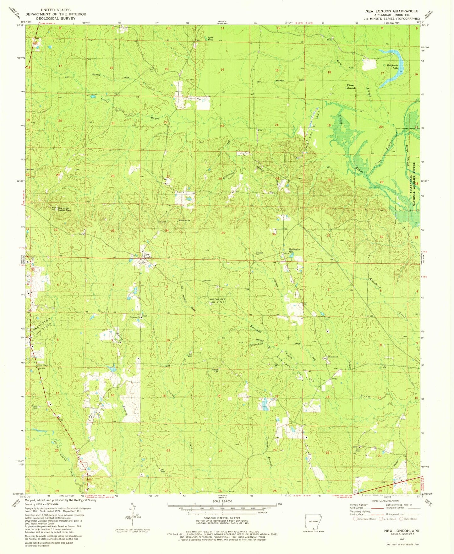
Historical USGS topographic quad map of New London in the state of Arkansas. Map scale may vary for some years, but is generally around 1:24,000. Print size is approximately 24" x 27"
This quadrangle is in the following counties: Union.
The map contains contour lines, roads, rivers, towns, and lakes. Printed on high-quality waterproof paper with UV fade-resistant inks, and shipped rolled.
Contains the following named places: Benjamin Lake, Cross Bayou, Deep Slough, Ebenezer Baptist Church, Ebenezer Cemetery, Ebenezer Church Cemetery, Ebenezer Presbyterian Church, George Cemetery, Gill Cemetery, Gill School, Greenhaw Branch, Gum Slough, McGlendon Mill, New London, New London Baptist Church, New London Cemetery, New London Lookout Tower, New London Oil Field, New London Post Office, Norris Cemetery, Norris Creek, North Lapile Creek, North New London Oil and Gas Field, Payne School, Pine Island, Poole Cemetery, Sawmill, Spice Pond, Strong Pumping Station, Tatum Branch, Township of Harrison, Union Chapel, Union School, Wallace Cemetery, Ward Chapel, Ward Chapel Cemetery, Williams Creek, Winchester Oil Field, ZIP Code: 71765