MyTopo
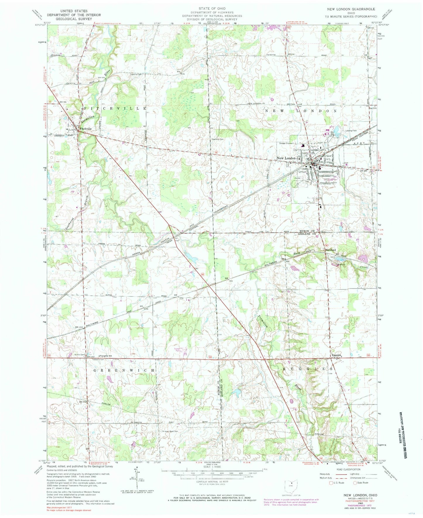
Classic USGS New London Ohio 7.5'x7.5' Topo Map
Couldn't load pickup availability
Historical USGS topographic quad map of New London in the state of Ohio. Map scale may vary for some years, but is generally around 1:24,000. Print size is approximately 24" x 27"
This quadrangle is in the following counties: Ashland, Huron.
The map contains contour lines, roads, rivers, towns, and lakes. Printed on high-quality waterproof paper with UV fade-resistant inks, and shipped rolled.
Contains the following named places: Biglow Airfield, Buck Creek, Crall Pond, Crall Pond Dam, Day Cemetery, Ekey School, Fayette Cemetery, Firelands Ambulance Service, First Baptist Church, Fitchville, Fitchville Cemetery, Fitchville Elementary School, Fitchville Post Office, Forks of Road Cemetery, Golding Cemetery, Grove Street Cemetery, Herefork, Holy Cross Catholic Cemetery, Kniffin Cemetery, Millstone Hills Golf Course, Mindzak Airfield, New London, New London Elementary School, New London Emergency Medical Services, New London Fire Department, New London High School, New London Hospital, New London Police Department, New London Post Office, New London Recreation Park, New London United Methodist Church, New London Upground Reservoir, New London Upground Reservoir Dam, Ninevah Road Cemetery, Our Lady of Lourdes Church, Quaker Cemetery, Ruggles, Ruggles Elementary School, Ruggles Post Office, Ruggles Township Cemetery, Second Baptist Church, Southwest Branch Vermilion River, Staples Pond, Staples Pond Dam, Township of Fitchville, Township of Greenwich, Township of New London, Township of Ruggles, Uke Ranch Pond, Uke Ranch Pond Dam, Village of New London, Woodlyn Acres, ZIP Codes: 44837, 44851