MyTopo
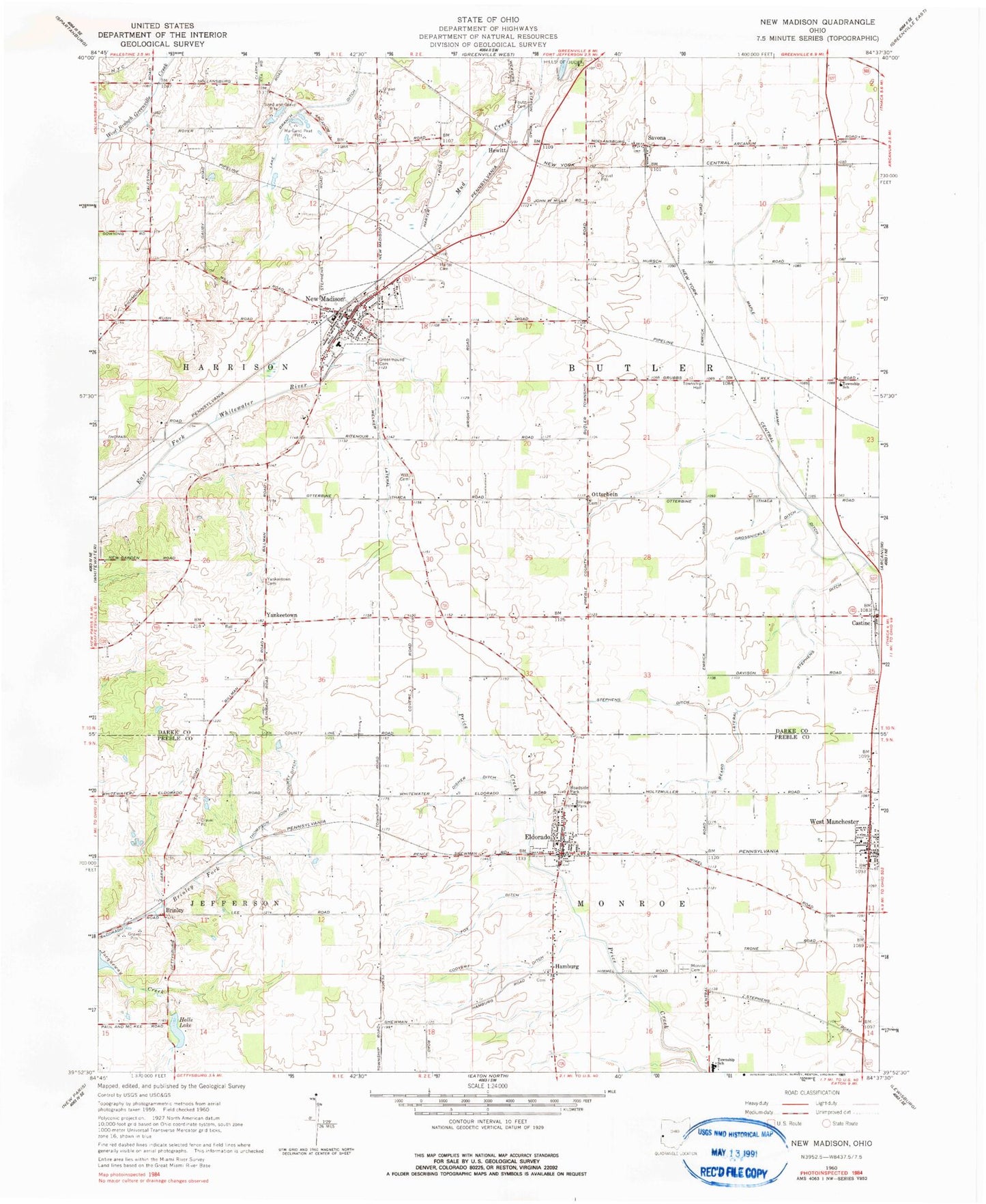
Classic USGS New Madison Ohio 7.5'x7.5' Topo Map
Couldn't load pickup availability
Historical USGS topographic quad map of New Madison in the state of Ohio. Map scale may vary for some years, but is generally around 1:24,000. Print size is approximately 24" x 27"
This quadrangle is in the following counties: Darke, Preble.
The map contains contour lines, roads, rivers, towns, and lakes. Printed on high-quality waterproof paper with UV fade-resistant inks, and shipped rolled.
Contains the following named places: Beard Lateral, Brinley, Brinley Post Office, Butler Middle School, C R Coblentz Middle School, Coovert Ditch, Disher Ditch, Eldorado, Eldorado Post Office, Eldorado United Methodist Church, Eldorado Village Fire Department, Etzler Farms, First Universalist Cemetery, First Universalist Church, Foutz Cemetery, Fox Ditch, Greenmound Cemetery, Grossnickle Ditch, Halls Lake, Hamburg, Hamburg Cemetery, Harter Cemetery, Hewitt, Lakeview School, M and M Farms, Maple Swamp Ditch, Marland Peat Pits, Monroe Cemetery, New Madison, New Madison Fire Department Station 11, New Madison Police Department, New Madison Post Office, New Madison United Methodist Church, North Central Ambulance District, Otterbein, Otterbein Cemetery, Ritzy Farm, Savona, Savona Post Office, Stephens Ditch, Sullenbarger Farms, Township of Butler, Tri - Village Rescue Services, Tri-Village High School, Unitarian Universalist Church, Vanzant Farms, Village of Eldorado, Village of New Madison, Village of West Manchester, Village Park, Welker Lateral, West Manchester, West Manchester Fire Department, West Manchester Post Office, Wilt Cemetery, Yankeetown, Yankeetown Cemetery, Yankeetown Post Office, ZIP Codes: 45321, 45346