MyTopo
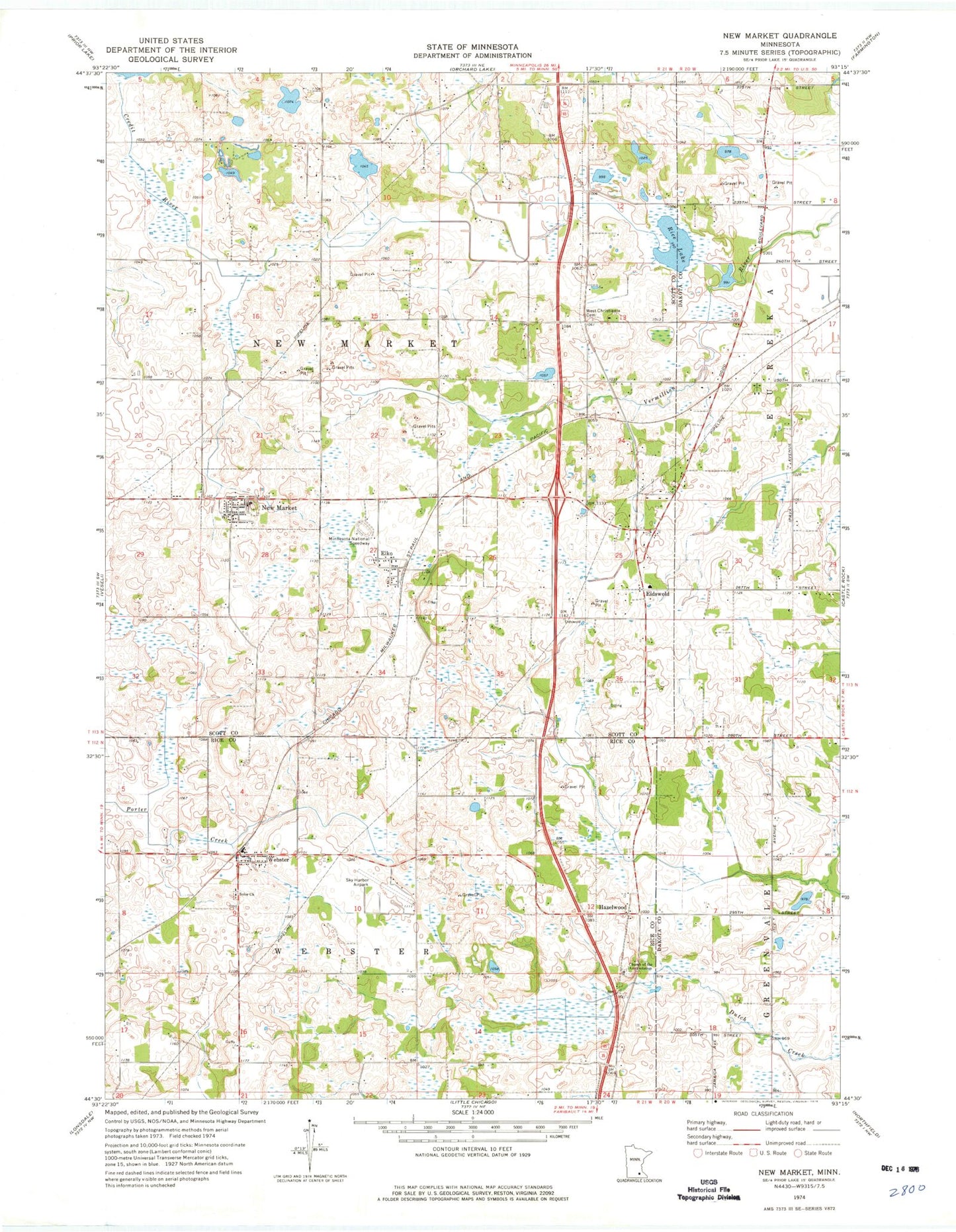
Classic USGS New Market Minnesota 7.5'x7.5' Topo Map
Couldn't load pickup availability
Historical USGS topographic quad map of New Market in the state of Minnesota. Map scale may vary for some years, but is generally around 1:24,000. Print size is approximately 24" x 27"
This quadrangle is in the following counties: Dakota, Rice, Scott.
The map contains contour lines, roads, rivers, towns, and lakes. Printed on high-quality waterproof paper with UV fade-resistant inks, and shipped rolled.
Contains the following named places: Annunciation Cemetery, Big Woods Historical Marker, Church of the Annunciation, City of Elko, City of Elko New Market, City of New Market, Eagle View Elementary School, Eidswold, Eidswold Post Office, Elko, Elko New Market, Elko New Market Fire Department, Elko New Market Police Department, Elko New Market Post Office, Hazelwood, Minnesota National Speedway, Nelson's Apple Farm, New Market, New Market City Hall, New Market Post Office, New Market Public Library, New Market South Bend Rest Area, Pettit Wildlife Pond, Pettit Wildlife Pond Dam, Rice Lake, Saint Nicholas Church, Sky Harbor Residential Airpark, Solor Church, Solor Lutheran Cemetery, Steve Maza Pond Dam, Sweetbrier Lake, Township of New Market, Township of Webster, Webster, Webster Post Office, West Christiania Cemetery, ZIP Codes: 55020, 55054