
MyTopo
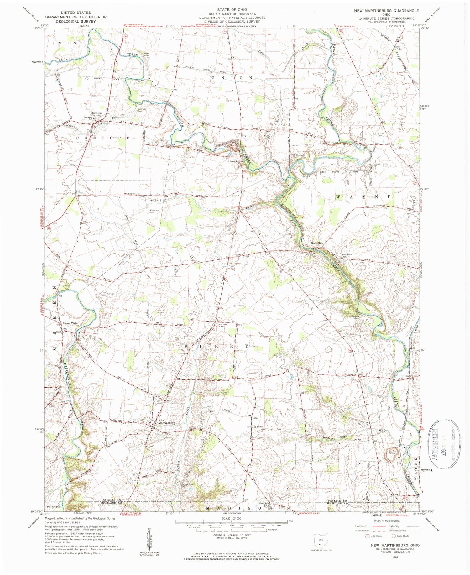
Classic USGS New Martinsburg Ohio 7.5'x7.5' Topo Map
Couldn't load pickup availability
Historical USGS topographic quad map of New Martinsburg in the state of Ohio. Map scale may vary for some years, but is generally around 1:24,000. Print size is approximately 24" x 27"
This quadrangle is in the following counties: Fayette, Highland.
The map contains contour lines, roads, rivers, towns, and lakes. Printed on high-quality waterproof paper with UV fade-resistant inks, and shipped rolled.
Contains the following named places: Anderson Cemetery, Aquilla School, Archer Cemetery, Black Farms, Blue Rock Quarry, Boyds, Buck Run, Buck Run School, Buckeye Hills Golf Course, Buena Vista, Buena Vista School, Carmean Cemetery, Cochran Cemetery, Coffman-Orr Cemetery, Concord - Green Township Volunteer Fire Department, Davis Cemetery, Ghormley, Hankins Run, Hyer Cemetery, Indian Creek, Locust Grove School, Mark Road Bridge, Merritt Airport, Methodist Episcopal Church, New Martinsburg, New Martinsburg Post Office, Pikes Peak School, Plainview School, Pone Creek, Post Ditch, Rock Mills, Rock Mills Cemetery, Rock Mills School, Shady Grove School, Sheep Pen Cemetery, Smithville School, Sollars Cemetery, Staunton, Staunton Cemetery, Staunton Elementary School, Staunton Post Office, Staunton United Methodist Church, Sugar Creek, Sugar Grove Cemetery, Sugar Grove School, Sugar Grove United Methodist Church, Sunshine School, Township of Perry, Township of Union, Wabash Creek, Walnut Creek Cemetery


