MyTopo
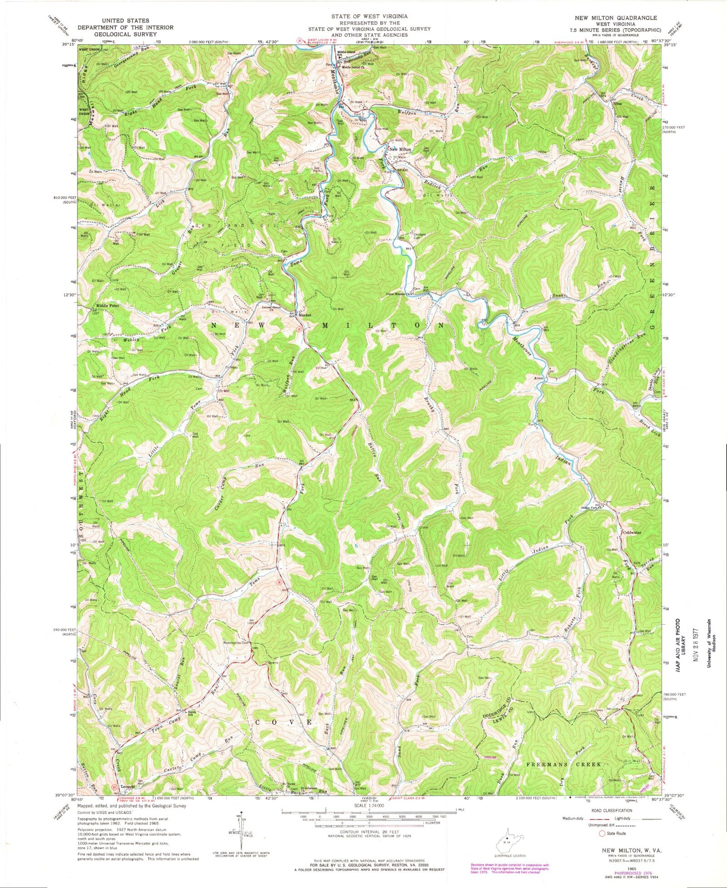
Classic USGS New Milton West Virginia 7.5'x7.5' Topo Map
Couldn't load pickup availability
Historical USGS topographic quad map of New Milton in the state of West Virginia. Map scale may vary for some years, but is generally around 1:24,000. Print size is approximately 24" x 27"
This quadrangle is in the following counties: Doddridge, Lewis.
The map contains contour lines, roads, rivers, towns, and lakes. Printed on high-quality waterproof paper with UV fade-resistant inks, and shipped rolled.
Contains the following named places: Avon, Avon United Methodist Church, Bancs Volunteer Fire Department, Batten Run, Beech Lick, Brushy Fork, Carder Camp Run, Carter Camp Run, Childers Cemetery, Coldwater, Coldwater Cemetery, Double Camp Run, Double Camp Run School, Grouse Run, Hunter Fork, Indian Fork, Indian Fork Baptist Church, Indian Fork Cemetery, Laurel Run, Leopold, Little Indian Fork, Little Toms Fork, Locust Grove United Methodist Church, Market, Maxwell School, Middle Island Cemetery, Middle Island School, Middle Island Seventh Day Baptist Church, Middle Point, Middle Point School, New Milton, New Milton Methodist Episcopal Church, New Milton Post Office, Nicholson Airport, Nina, Oak District, Randolph School, Redemption Cemetery, Redlick Run, Right Hand Fork Lick Run, Right Hand Fork Little Toms Fork, Roberts Fork, Roberts Fork School, Rodas School, Saint Clara Cemetery, Saint Claras Church, Saint Johannes Church, Smith School, Snake Run, Snake Run School, Snider Cemetery, Snyder School, Spring Run, Standingstone Run, Sugar Camp, Sugar Grove School, Sugarcamp Run, Toms Fork, Toms Fork Cemetery, Town Camp Run, Union Mission Cemetery, Union Mission Church, Upper Indian Fork School, Upper Saint Clara School, Valley Church, Webley Fork, Wolfpen Run, ZIP Code: 26411