MyTopo
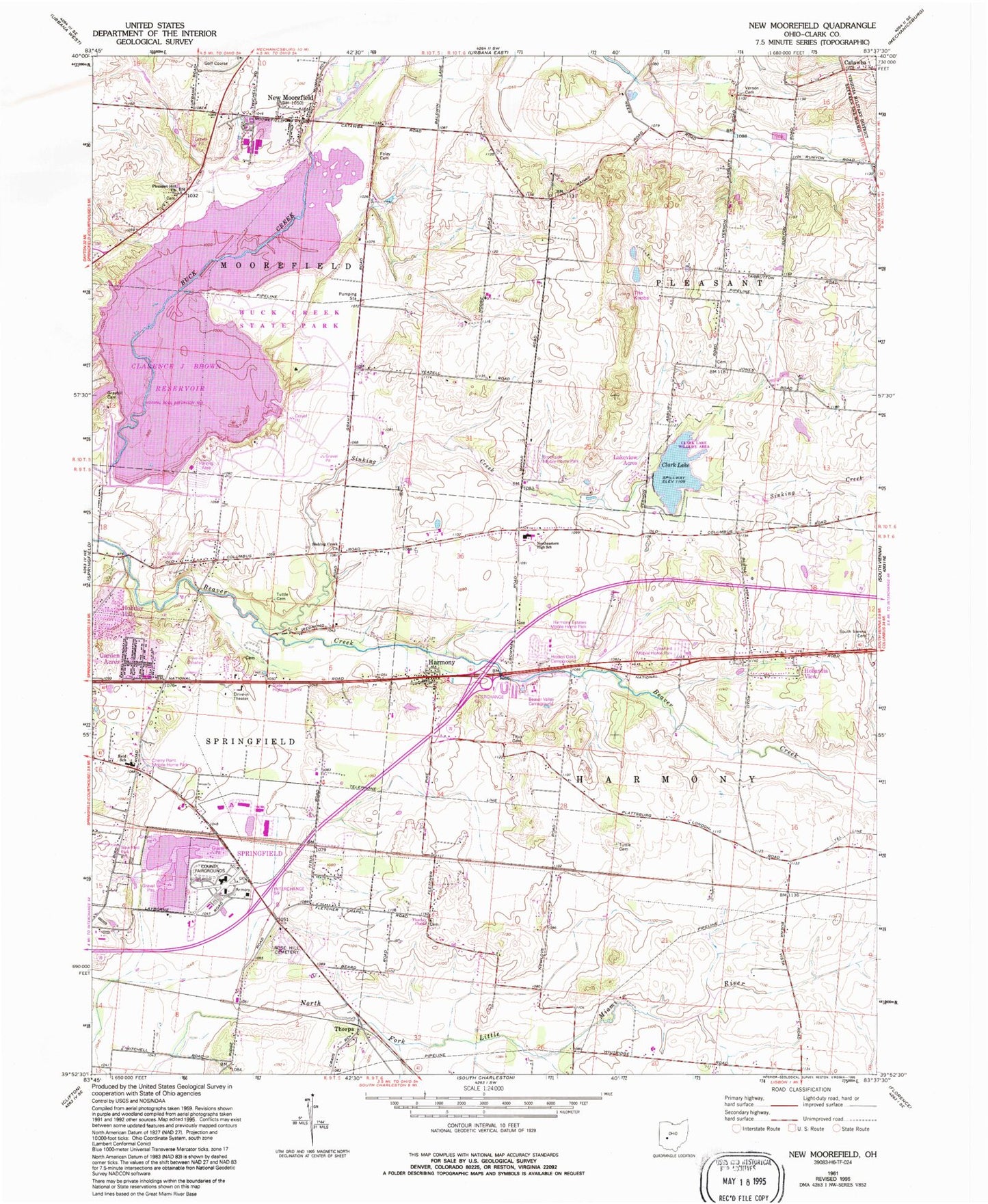
Classic USGS New Moorefield Ohio 7.5'x7.5' Topo Map
Couldn't load pickup availability
Historical USGS topographic quad map of New Moorefield in the state of Ohio. Map scale may vary for some years, but is generally around 1:24,000. Print size is approximately 24" x 27"
This quadrangle is in the following counties: Clark.
The map contains contour lines, roads, rivers, towns, and lakes. Printed on high-quality waterproof paper with UV fade-resistant inks, and shipped rolled.
Contains the following named places: Asbury Chapel Cemetery, Asbury Church, Beaver Valley Campground, Brookside Park Mobile Home Park, Buck Creek State Park, Cherry Point Mobile Home Park, Clarence J Brown Dam, Clarence J Brown Reservoir, Clark County Fairgrounds, Clark Lake, Clark Lake Dam, Clark Lake Wildlife Area, Crawford Mobile Home Park, Fletcher Chapel, Fletcher Chapel Cemetery, Foley Cemetery, Garden Acres, Graybill Cemetery, Harmony, Harmony Estates Mobile Home Park, Harmony Post Office, Hidden Oakes Campground, Holiday Hills, Hollandia View, Kepes Flying Field, Lakeview Acres, Lakeview Trail, Melody Cruise-In, Mitchell Hills Country Club, Moorefield Township Hall, New Moorefield, New Moorefield Post Office, New Moorefield School, Newlove School, Northeastern High School, Ohio State Highway Patrol - Springfield Patrol Post, Oxtoby, Oxtoby Post Office, Pleasant Hill Cemetery, Pleasant Hill Church, Prairie Road Fen State Nature Preserve, Primeohio Corporate Park, Reid Elementary School, Reid Memorial Park, Rose Hill Cemetery, Sinking Creek, Sinking Creek Baptist Church, South Vienna Cemetery, Springfield Sand and Gravel Pit, Summerford Post Office, The Knobs, Thorps, Titus Cemetery, Township of Harmony, Township of Moorefield, Tuttle Cemetery, Vernon Cemetery, Yale Cemetery, Yeazel School