MyTopo
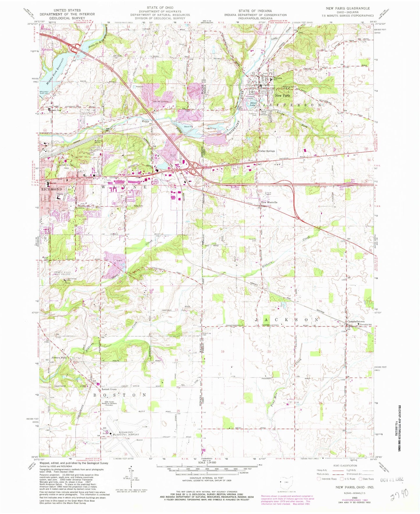
Classic USGS New Paris Ohio 7.5'x7.5' Topo Map
Couldn't load pickup availability
Historical USGS topographic quad map of New Paris in the states of Ohio, Indiana. Map scale may vary for some years, but is generally around 1:24,000. Print size is approximately 24" x 27"
This quadrangle is in the following counties: Preble, Wayne.
The map contains contour lines, roads, rivers, towns, and lakes. Printed on high-quality waterproof paper with UV fade-resistant inks, and shipped rolled.
Contains the following named places: Beam Bridge, Belfast, C R Coblentz Elementary School, Campbellstown, Campbellstown Post Office, Campbellstown United Church of Christ, Cedar Springs, Charles Elementary School, Church of Christ, Deaton Farms, Elkhorn Falls, First United Presbyterian Church, Forest Hills Golf Course, France Park, Glen Haven Memorial Gardens, Glenn Miller Park, Jordan Farms, Julia E Test Junior High School, Little Creek, Locust Grove, Middle Fork Reservoir, Middleboro Pit, New Paris, New Paris Post Office, New Westville, New Westville Friends Church, New Westville Post Office, Northwest Fire Department and Ambulance District, Pleasant View Junior High School, Richmond Fire Department Station 3, Richmond Municipal Airport, Ridge Cemetery, Rocky Fork, Saint Paul United Methodist Church, Silver Lake, Spring Lawn Cemetery, State Line Cemetery, Straszheim Farms, Terrebonne Farms, Township of Boston, Township of Jackson, Township of Jefferson, Village of New Paris, Wernle Cemetery, Wesler Orchards, Westville Cemetery, Westville Station