MyTopo
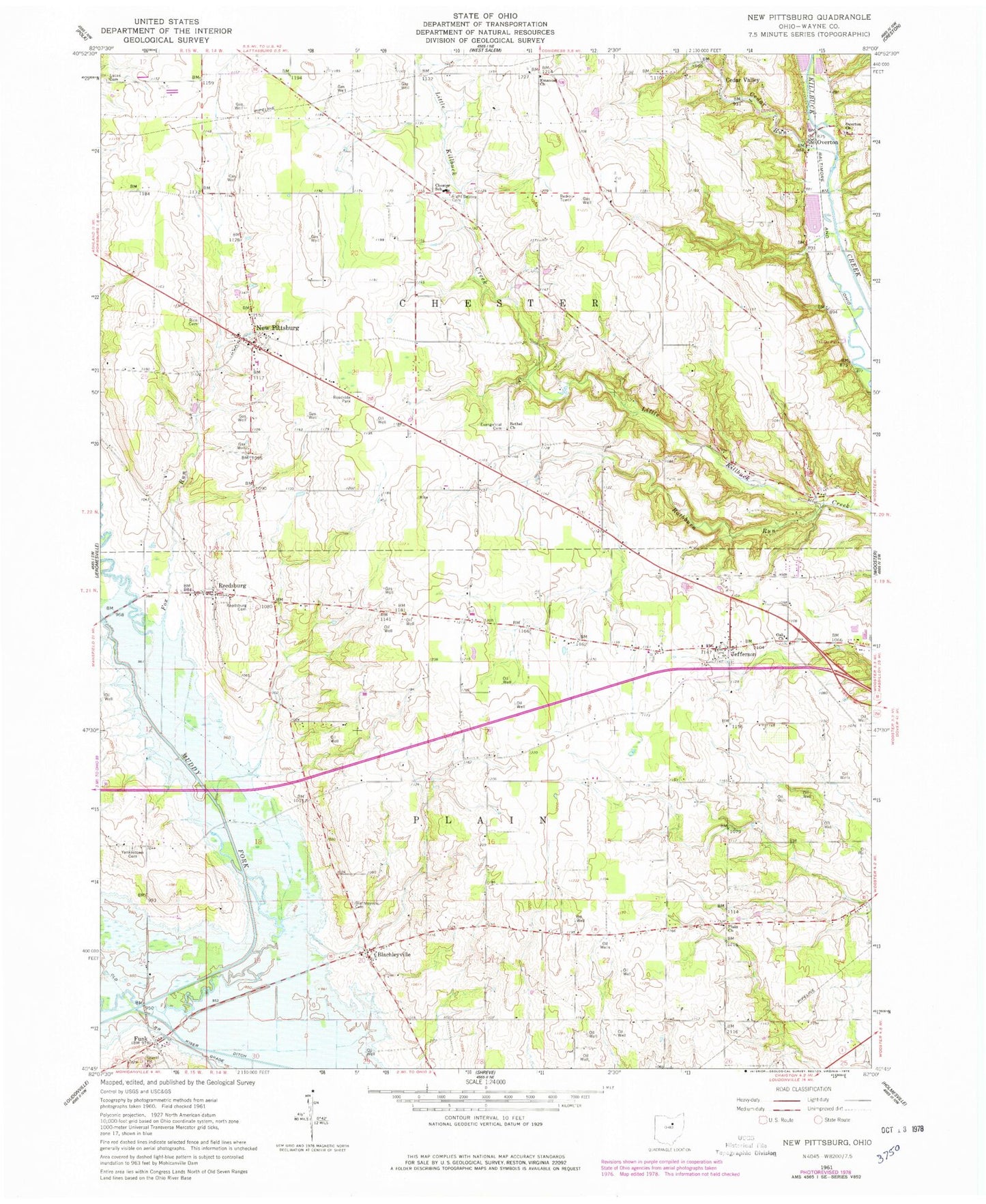
Classic USGS New Pittsburg Ohio 7.5'x7.5' Topo Map
Couldn't load pickup availability
Historical USGS topographic quad map of New Pittsburg in the state of Ohio. Map scale may vary for some years, but is generally around 1:24,000. Print size is approximately 24" x 27"
This quadrangle is in the following counties: Wayne.
The map contains contour lines, roads, rivers, towns, and lakes. Printed on high-quality waterproof paper with UV fade-resistant inks, and shipped rolled.
Contains the following named places: Bethel Cemetery, Bethel Church, Big Prairie, Blachleyville, Blachleyville Cemetery, Cedar Run, Cedar Valley, Chester School, Chestervue Farms, Crooked Barn Farm, Douce Farm, Eight Square, Eight Square Cemetery, Emanuel United Church of Christ, Evangelical Cemetery, Firebaugh Farms, Firetech Dairy Farm, Fox Run, Funk, Funk Bottoms, Gorman-Green Airport, Hartman Dairy Farm, Jefferson, Jefferson Cemetery, Kinny Farm, Lasue Dairy, Lingle Holstein Farms, Little Killbuck Farms, Lucas Cemetery, McKay Farms, McLaughlin Farm, Mowrer Lake Dam, Muddy Fork Farm, New Pittsburg, New Pittsburg Census Designated Place, New Pittsburg Fire Department, New Pittsburg United Methodist Church, Oak Chapel United Methodist Church, Overton, Overton Church of God, Overton Church of God Cemetery, Plain Lutheran Cemetery, Plain Lutheran Church, Raimonde Farms, Rathburn Run, Redick Farms, Reedsburg, Reedsburg Cemetery, Rice Cemetery, Rice Farms, Rittenhouse Farm, Schirm Jersey Farm, Stull Farm, Toppglen Farm, Township of Chester, Township of Plain, Wolf Spring Run Farm, Yankeetown Cemetery