MyTopo
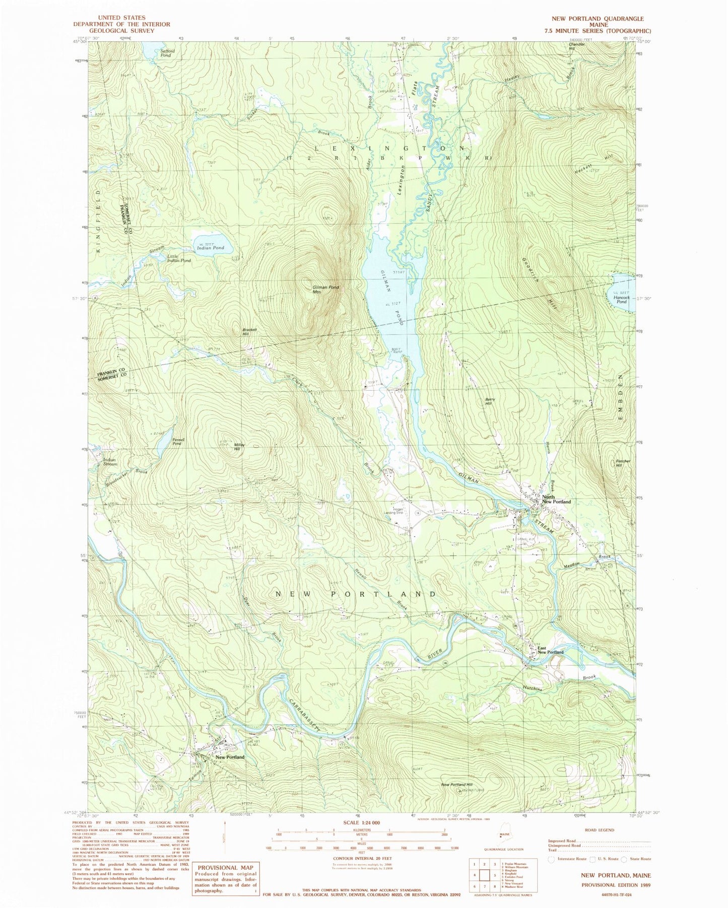
Classic USGS New Portland Maine 7.5'x7.5' Topo Map
Couldn't load pickup availability
Historical USGS topographic quad map of New Portland in the state of Maine. Map scale may vary for some years, but is generally around 1:24,000. Print size is approximately 24" x 27"
This quadrangle is in the following counties: Franklin, Somerset.
The map contains contour lines, roads, rivers, towns, and lakes. Printed on high-quality waterproof paper with UV fade-resistant inks, and shipped rolled.
Contains the following named places: Alder Brook, Berry Hill, Bloodsucker Brook, Brackett Hill, Center School, Central Elementary School, Clarks Brook, Dirigo Dowel Dam, Dyer Brook, East New Portland, East New Portland Cemetery, Fletcher Hill, Gilman Pond, Gilman Pond Mountain, Gilman Stream, Gilman Stream Dam, Gilman Stream Reservoir, Goodrich Hill, Greenleaf Cemetery, Hackett Hill, Happy Horseshoe Campground, Harris Brook, Healey Brook, Hogans Field, Indian Pond, Indian Stream, Lemon Stream, Lexington, Lexington Flats, Little Alder Brook, Little Indian Pond, Meadow Brook, Millay Hill, Millay School, New Portland, New Portland Community Library, New Portland Fire Department, New Portland Hill, New Portland Post Office, New Portland Wire Bridge, Newell Brook, North New Portland, North New Portland Cemetery, Parsons School, Pennell Pond, Pennell Pond Dam, Red School, Sandy Stream, Sucker Brook, Town of New Portland, West New Portland Cemetery