MyTopo
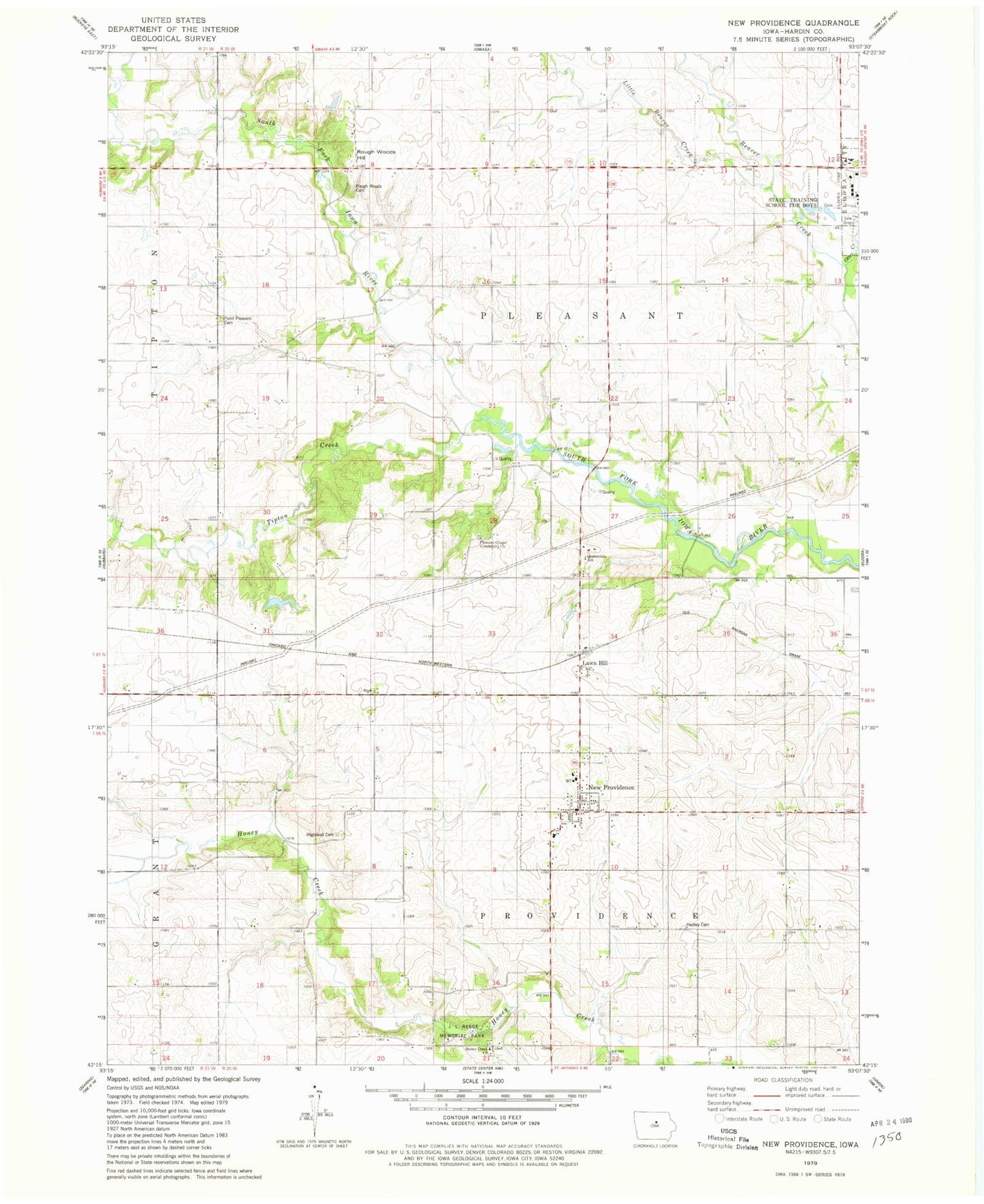
Classic USGS New Providence Iowa 7.5'x7.5' Topo Map
Couldn't load pickup availability
Historical USGS topographic quad map of New Providence in the state of Iowa. Map scale may vary for some years, but is generally around 1:24,000. Print size is approximately 24" x 27"
This quadrangle is in the following counties: Hardin.
The map contains contour lines, roads, rivers, towns, and lakes. Printed on high-quality waterproof paper with UV fade-resistant inks, and shipped rolled.
Contains the following named places: Bunker Hill Post Office, City of New Providence, Eldora Training School Cemetery, First Church/Cemetery Historical Marker, Hadley Cemetery, Highland Cemetery, Honey Creek Cemetery, Honey Creek Church, J L Reece Memorial Park, Lawn Hill, Lawnhill Post Office, Little Beaver Creek, Midland Post Office, New Providence, New Providence Cemetery, New Providence Fire Department, New Providence Post Office, New Providence Town Hall, Otter Creek, Pleasant Chapel Community Cemetery, Pleasant Chapel Community Church, Point Pleasant, Point Pleasant Cemetery, Point Pleasant Post Office, Quakerdale School, Quebec Post Office, Rough Woods Cemetery, Rough Woods Hill, Tipton Creek, Township of Pleasant, Township of Providence, Ziesman Wildlife Area