MyTopo
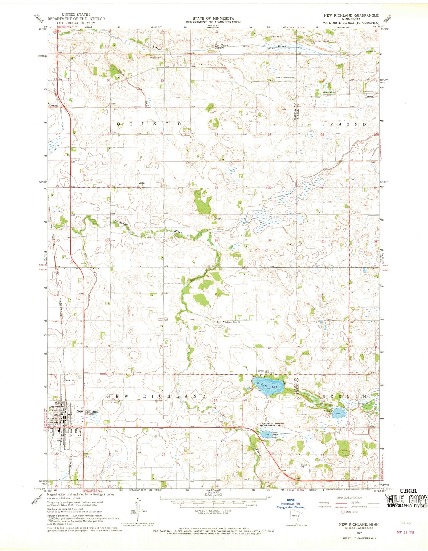
Classic USGS New Richland Minnesota 7.5'x7.5' Topo Map
Couldn't load pickup availability
Historical USGS topographic quad map of New Richland in the state of Minnesota. Map scale may vary for some years, but is generally around 1:24,000. Print size is approximately 24" x 27"
This quadrangle is in the following counties: Steele, Waseca.
The map contains contour lines, roads, rivers, towns, and lakes. Printed on high-quality waterproof paper with UV fade-resistant inks, and shipped rolled.
Contains the following named places: Calvary Cemetery, Church of All Saints, City of New Richland, County Ditch Number Thirtythree, County Ditch Number Twentyseven, First Congregational Church, Fosilen Lake, Johnson Oakside Orchard, Judicial Ditch Number Five, Le Sueur River American Lutheran Church Cemetery, Le Sueur River Church, Lemond, Lemond Post Office, New Richland, New Richland Ambulance, New Richland Care Center, New Richland City Hall, New Richland Clinic, New Richland Fire Department, New Richland Police Department, New Richland Post Office, New Richland Public Library, New Richland Public School, Otisco - Lemond Cemetery, Otisco Cemetery, Pontoppidan Lutheran Cemetery, Pontoppidan Lutheran Church, Reese Lake, Saint Olaf Cemetery, Saint Olaf Lake, Saint Olaf Lake Dam, Saint Olaf Lake Park, Saint Peter's Lutheran Church, School Number 2137, Teal State Wildlife Management Area, Township of New Richland, Township of Otisco, Trinity Lutheran Church, Vista, Vista Covenant Church Cemetery, Vista Evangelical Covenant Church, Vista Lutheran Church, Vista Post Office, Vista Swedish Lutheran Church Cemetery