MyTopo
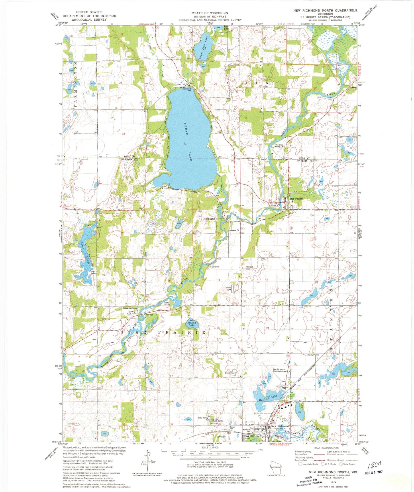
Classic USGS New Richmond North Wisconsin 7.5'x7.5' Topo Map
Couldn't load pickup availability
Historical USGS topographic quad map of New Richmond North in the state of Wisconsin. Map scale may vary for some years, but is generally around 1:24,000. Print size is approximately 24" x 27"
This quadrangle is in the following counties: Polk, St. Croix.
The map contains contour lines, roads, rivers, towns, and lakes. Printed on high-quality waterproof paper with UV fade-resistant inks, and shipped rolled.
Contains the following named places: Cedar Creek, Cedar Lake, Cedar Lake School, Ceder Lake Seaplane Base, Danielson Field, First Baptist Church, First Lutheran Church, Hatfield Lake, Hatfield Park, Hexum Flight Park, Horse Creek, Huntington, Johannesburg, Life Link New Richmond Ambulance Service, Lower Pine Lake, Mary Park, Munson Lake, New Richmond City Landfill, New Richmond Fire Department Star Prairie Station, New Richmond Regional Airport, Northside Park, Oakland Cemetery, Prairie View School, River View School, Saint Croix Health Center, Squaw Lake, Squaw Lake School, Stanton Townhall, Star Prairie, Star Prairie Police Department, Star Prairie Post Office, Star Prairie Townhall, Strand Lake, Swedish Evangelical Lutheran Church, Town of Star Prairie, Village of Star Prairie, Wall Street Village, Woodbridge Trailer Court, Woodridge Mobile Home Park, ZIP Code: 54026