MyTopo
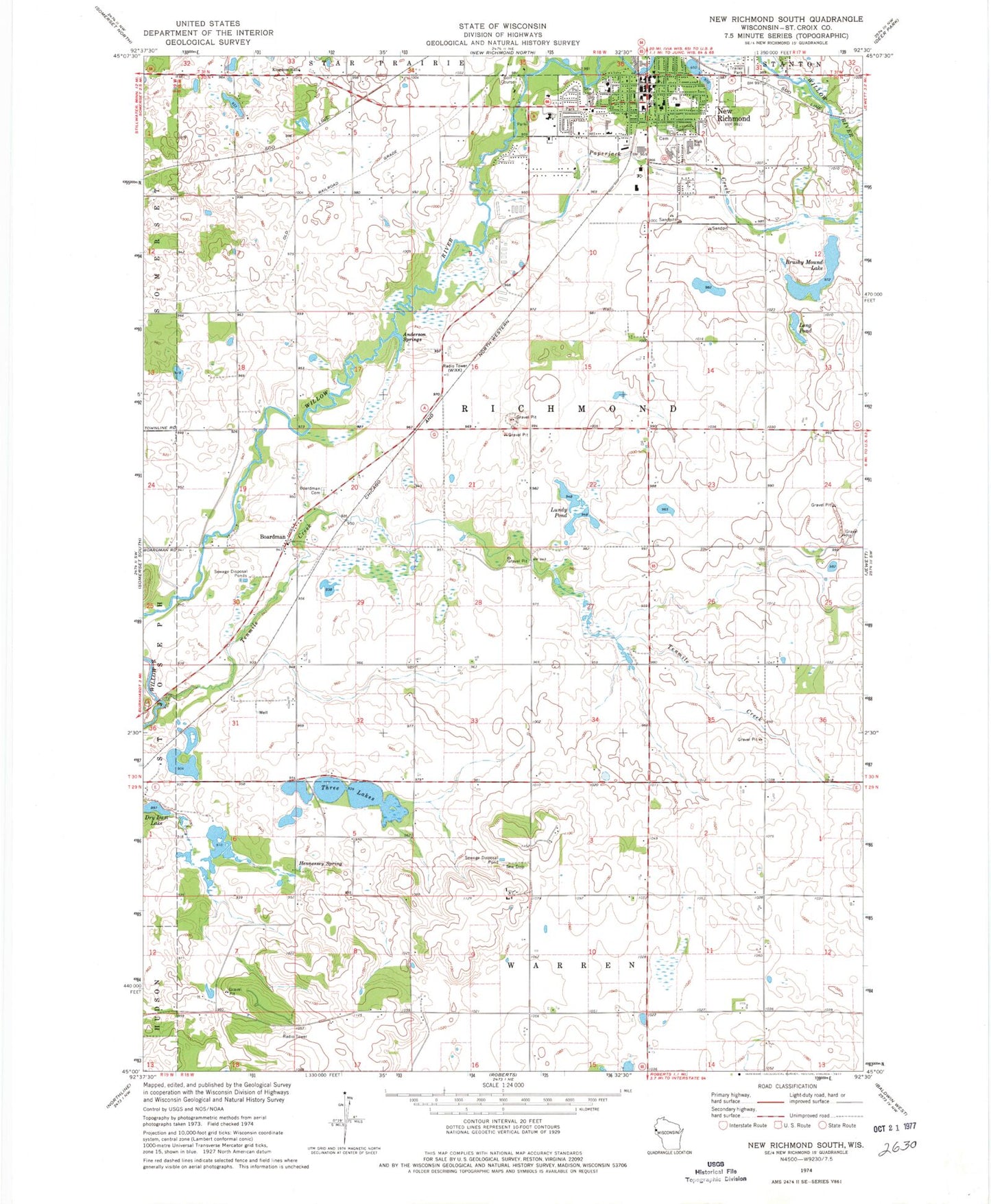
Classic USGS New Richmond South Wisconsin 7.5'x7.5' Topo Map
Couldn't load pickup availability
Historical USGS topographic quad map of New Richmond South in the state of Wisconsin. Map scale may vary for some years, but is generally around 1:24,000. Print size is approximately 24" x 27"
This quadrangle is in the following counties: St. Croix.
The map contains contour lines, roads, rivers, towns, and lakes. Printed on high-quality waterproof paper with UV fade-resistant inks, and shipped rolled.
Contains the following named places: Anderson Springs, Boardman, Boardman Cemetery, Brushy Mound Lake, Carleton A Friday Memorial Library, Citizens Field, City of New Richmond, Clarendon School, Flying M Ranch Airport, Glover Park, Hennessey Spring, Immaculate Conception Catholic Church, Immaculate Conception Catholic Church Cemetery, Lonesome Trail School, Long Pond, Lundy Pond, Monette Park, New Richmond, New Richmond Area Ambulance, New Richmond Fire and Rescue, New Richmond Flowage 146, New Richmond Golf Course, New Richmond High School, New Richmond Middle School, New Richmond Mills Dam, New Richmond Police Department, New Richmond Post Office, NR4Kids Charter School, Oak Hill School, Paper Jack Park, Paperjack Creek, Paperjack Elementary School, Riverside, Rusmar Farms Airport, Saint Mary School, Spring Brook School, Starr Elementary School, Tenmile Creek, Three Lakes, Town of Richmond, Twin Pond School, Westfields Hospital, WIXK-AM (New Richmond), WIXK-FM (New Richmond), ZIP Code: 54017