MyTopo
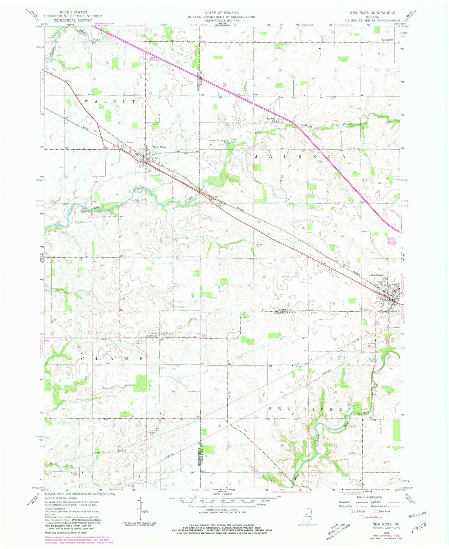
Classic USGS New Ross Indiana 7.5'x7.5' Topo Map
Couldn't load pickup availability
Historical USGS topographic quad map of New Ross in the state of Indiana. Map scale may vary for some years, but is generally around 1:24,000. Print size is approximately 24" x 27"
This quadrangle is in the following counties: Boone, Hendricks, Montgomery.
The map contains contour lines, roads, rivers, towns, and lakes. Printed on high-quality waterproof paper with UV fade-resistant inks, and shipped rolled.
Contains the following named places: Adams Cemetery, Advance Conservation Club, Brown Cemetery, Fullen Cemetery, Granville Wells Elementary School, Hicks Cemetery, Hypes Cemetery, Jamestown, Jamestown Fire Department, Jamestown Post Office, Jamestown Volunteer Fire Department, Kidd Farm Cemetery, Ladoga Rest Park, Mount Pleasant Cemetery, Mount Zion Church, New Ross, New Ross Cemetery, New Ross Post Office, Pennington Cemetery, Porter Cemetery, Town of Jamestown, Town of New Ross, Walnut Elementary School, Walnut Township Fire Department, Wesley Cemetery, ZIP Code: 47968