MyTopo
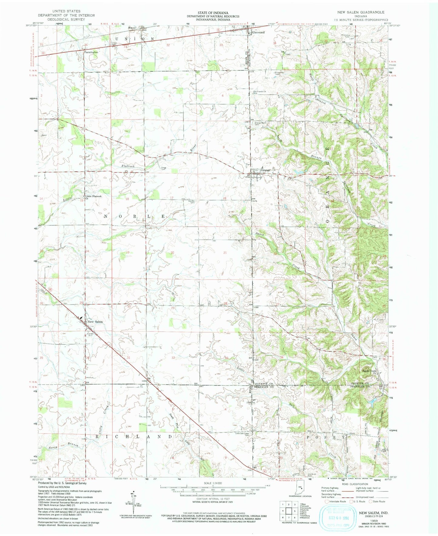
Classic USGS New Salem Indiana 7.5'x7.5' Topo Map
Couldn't load pickup availability
Historical USGS topographic quad map of New Salem in the state of Indiana. Map scale may vary for some years, but is generally around 1:24,000. Print size is approximately 24" x 27"
This quadrangle is in the following counties: Fayette, Franklin, Rush.
The map contains contour lines, roads, rivers, towns, and lakes. Printed on high-quality waterproof paper with UV fade-resistant inks, and shipped rolled.
Contains the following named places: Bever Cemetery, Farmington, Glenwood Volunteer Fire Department, Gregg Cemetery, Heaton Cemetery, Hilltop Cemetery, Little Flatrock Church, Little Salt Creek Cemetery, Mauzy, McMinn Airport, New Salem, New Salem Elementary and Junior High School, Old Brick Cemetery, Old Friends Church Cemetery, Old Orange Cemetery, Orange, Orange Cemetery, Sanes Creek Church, Township of Noble, Township of Orange, Woodland Retreat Dam, Woodland Retreat Lake, ZIP Code: 46133