MyTopo
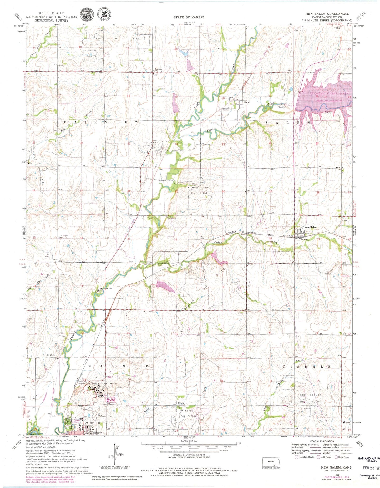
Classic USGS New Salem Kansas 7.5'x7.5' Topo Map
Couldn't load pickup availability
Historical USGS topographic quad map of New Salem in the state of Kansas. Map scale may vary for some years, but is generally around 1:24,000. Print size is approximately 24" x 27"
This quadrangle is in the following counties: Cowley.
The map contains contour lines, roads, rivers, towns, and lakes. Printed on high-quality waterproof paper with UV fade-resistant inks, and shipped rolled.
Contains the following named places: Abel Ranch Airport, Biddle Oil Field, Cedar Creek, Cedarview School, Country View Elementary School, Davis Field, Deichman Oil Field, Dutch Creek, Floral, Grand View Church, Grand View School, Grandview United Methodist Church, Harmony School, Hittle Oil Field, Kansas Veterans' Cemetery at Winfield, Kansas Veteran's Home Bleckley Hall, Kansas Veteran's Home Donlon Hall, KYQQ - FM (Winfield), Maple Grove School, New Salem, New Salem Census Designated Place, Olive School, Science Valley School, Sunnyside School, Township of Fairview, Township of Salem, Township of Walnut, Union Cemetery, Wilmot Floral Oil Field, Winfield Correctional Facility, Winfield State Hospital, Winfield Water Treatment Plant, ZIP Code: 67156