MyTopo
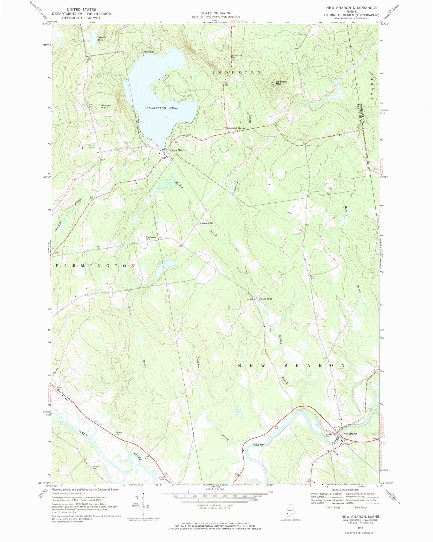
Classic USGS New Sharon Maine 7.5'x7.5' Topo Map
Couldn't load pickup availability
Historical USGS topographic quad map of New Sharon in the state of Maine. Map scale may vary for some years, but is generally around 1:24,000. Print size is approximately 24" x 27"
This quadrangle is in the following counties: Franklin, Somerset.
The map contains contour lines, roads, rivers, towns, and lakes. Printed on high-quality waterproof paper with UV fade-resistant inks, and shipped rolled.
Contains the following named places: Allens Mills, Allens Mills Cemetery, Bannock Mountain, Beales Brook, Blake Cemetery, Bragdon Brook, Bullen Mills, Center Hill Cemetery, Clearwater Pond, Goodrich Brook, Goodrich Corner, Gower Cemetery, Industry Volunteer Fire Department, Jim Ditzler Memorial Library, Lowell Cemetery, Mosher Hill, Mosher Hill Cemetery, Mosher Pond, Muddy Brook, New Sharon, New Sharon Congregational Church-United Church of Christ, New Sharon Fire Station, New Sharon Post Office, Overlake, Perham Hill, Pike Cemetery, Riverside Cemetery, Sewall Cemetery, Shaw Cemetery, Town of New Sharon, Village Cemetery, Weeks Mills, Weeks Mills Cemetery, Wendall Davis Cemetery, ZIP Code: 04938