MyTopo
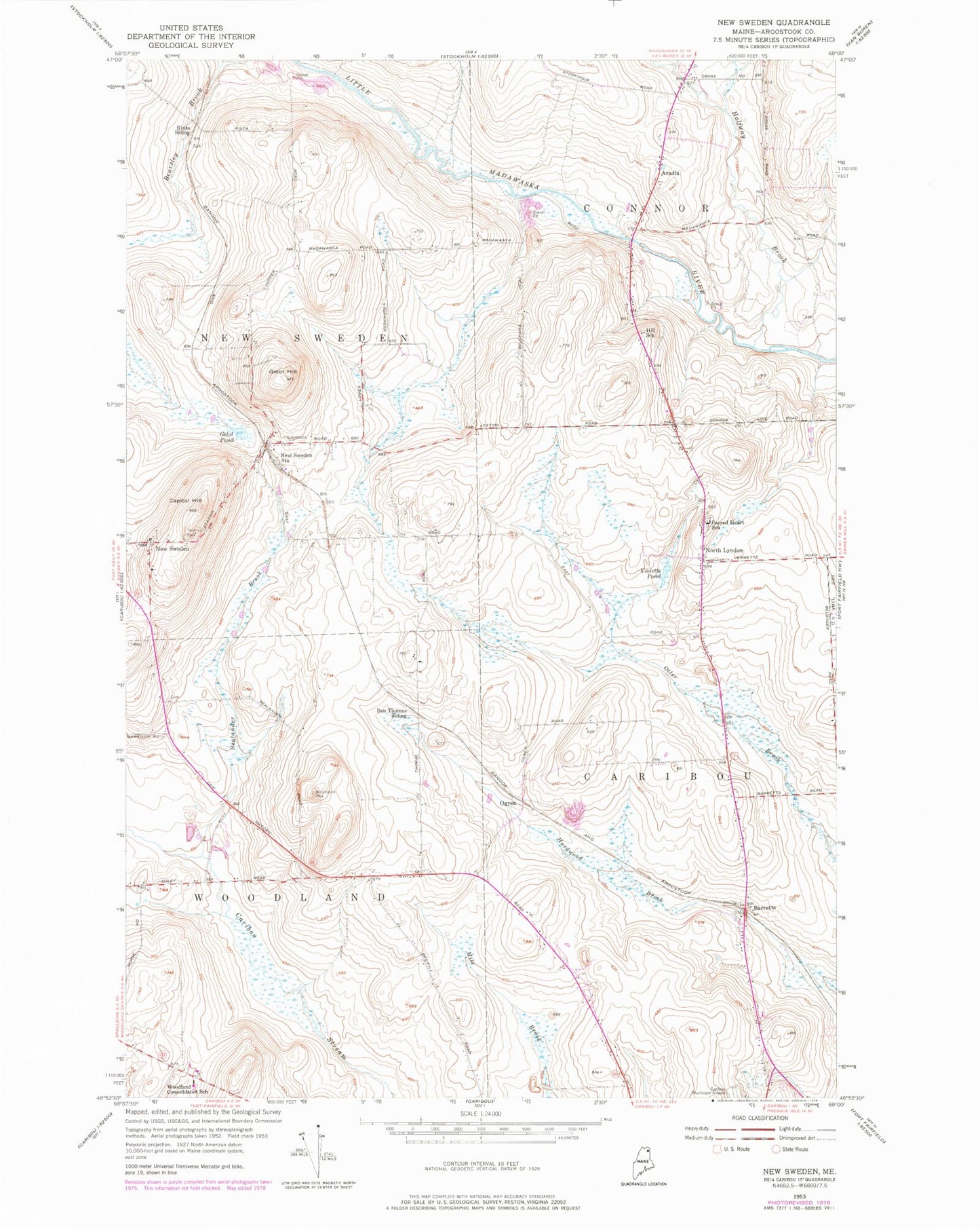
Classic USGS New Sweden Maine 7.5'x7.5' Topo Map
Couldn't load pickup availability
Historical USGS topographic quad map of New Sweden in the state of Maine. Map scale may vary for some years, but is generally around 1:24,000. Print size is approximately 24" x 27"
This quadrangle is in the following counties: Aroostook.
The map contains contour lines, roads, rivers, towns, and lakes. Printed on high-quality waterproof paper with UV fade-resistant inks, and shipped rolled.
Contains the following named places: Acadia, Aroostook Band of Micmac Tribal Designated Statistical Area, Barretts, Ben Thomas Siding, Capitol Hill, Capitol Hill Cemetery, Cary Medical Center, Cary Medical Center Community Health Resource Library, Connor Consolidated School, Gelot Hill, Gelot Pond, Halfway Brook, Johnson Cemetery, Little Black Brook, New Holy Rosary Cemetery, New Sweden, New Sweden Post Office, New Sweden Station, North Lyndon, Ogren, Picard Brook, Rista Siding, Sacred Heart Cemetery, Sacred Heart School, Sealander Brook, Thomas Park, Town of New Sweden, Town of Woodland, Violette Pond, WFST-AM (Caribou), Williams Family Cemetery, Woodland Cemetery, Woodland Consolidated School, ZIP Codes: 04736, 04762