MyTopo
Classic USGS New Union Arkansas 7.5'x7.5' Topo Map
Couldn't load pickup availability
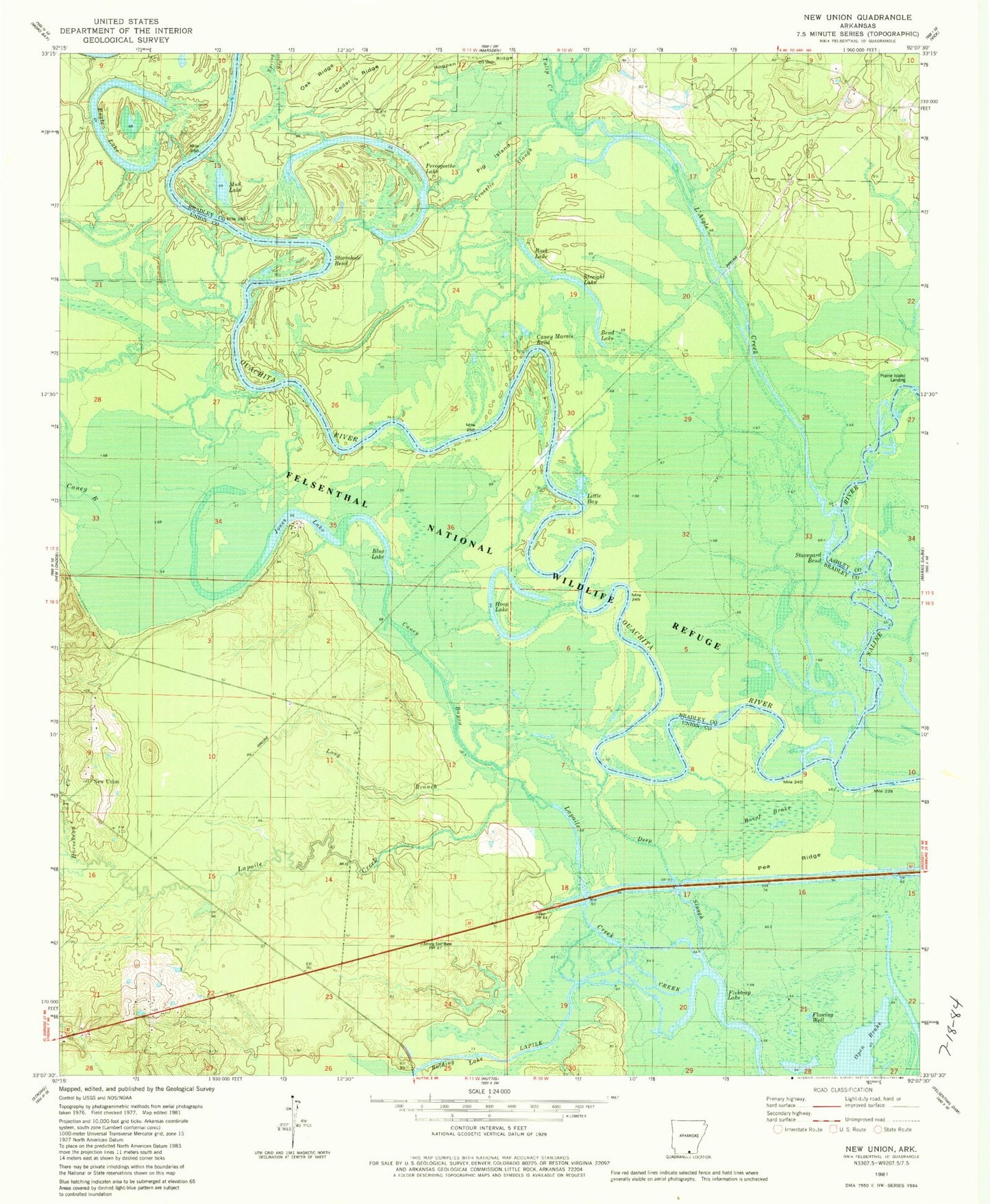
Historical USGS topographic quad map of New Union in the state of Arkansas. Map scale may vary for some years, but is generally around 1:24,000. Print size is approximately 24" x 27"
This quadrangle is in the following counties: Ashley, Bradley, Union.
The map contains contour lines, roads, rivers, towns, and lakes. Printed on high-quality waterproof paper with UV fade-resistant inks, and shipped rolled.
Contains the following named places: Bend Lake, Blue Lake, Boeut Brake, Bolding Lake, Buck Lake, Caney Bayou, Caney Marais Bend, Cedar Ridge, Crosstie Slough, Deep Slough, Eagle Lake, Fishtrap Lake, Frank Lake, Hogpen Ridge, Hoop Lake, Horsehead Creek, Jones Lake, Lagle Creek, L'Aigle Creek, Lapoile Creek, Little Bay, Long Branch, Middle Lake, Mud Lake, New Union, Oak Ridge, Open Brake, Pea Ridge, Pereogeethe Lake, Pig Island, Pine Island, Prairie Island Log, Saline River, Staveyard Bend, Stormhole Bend, Straight Lake, Tulip Creek