MyTopo
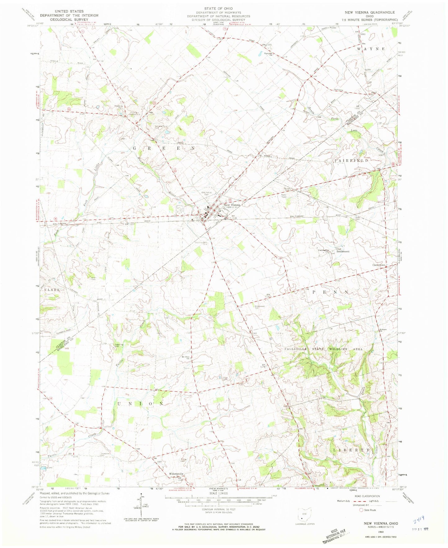
Classic USGS New Vienna Ohio 7.5'x7.5' Topo Map
Couldn't load pickup availability
Historical USGS topographic quad map of New Vienna in the state of Ohio. Map scale may vary for some years, but is generally around 1:24,000. Print size is approximately 24" x 27"
This quadrangle is in the following counties: Clinton, Highland.
The map contains contour lines, roads, rivers, towns, and lakes. Printed on high-quality waterproof paper with UV fade-resistant inks, and shipped rolled.
Contains the following named places: Achor Cemetery, Auburn Cemetery, Auburn Methodist Church, Bloomington Post Office, Brick School, Burnett Cemetery, Careytown, Careytown Farms, Careytown Post Office, Carthagenia Church, Clark Cemetery, Clear Creek School, Clinton Highland Joint Fire District, Duncan School, Emerald Pines Mobile Home Park, Fairview Church, Fallsville, Fallsville State Wildlife Area, Fetterling Cemetery, Gist Cemetery, Gist Settlement, Green Township House, Lynchburg Quarry, M and M Farm, McCoy Cemetery, Mount Olive Cemetery, Mount Olive Church, New Vienna, New Vienna Cemetery, New Vienna Church of Christ, New Vienna Elementary School, New Vienna Municipal Building, New Vienna Police Department, New Vienna Post Office, New Vienna United Methodist Church, Newby School, Pitstick Farms, Plainview School, Polk Cemetery, Polk School, Sharpsville, Sharpsville Post Office, Shockley-Ross Cemetery, Snow Hill, Snow Hill Country Club, Snow Hill Post Office, Swingley Farm Cemetery, Terrell Airport, Thompson Cemetery, Township of Green, Township of Union, Underwood Cemetery, Village of New Vienna, Willettsville, Willettville Post Office, ZIP Code: 45159