MyTopo
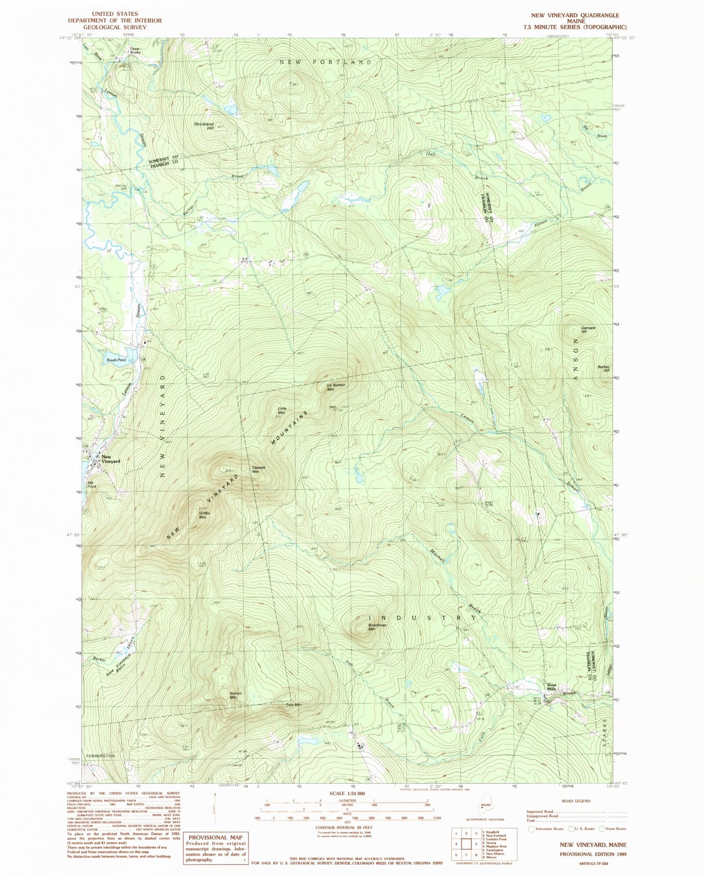
Classic USGS New Vineyard Maine 7.5'x7.5' Topo Map
Couldn't load pickup availability
Historical USGS topographic quad map of New Vineyard in the state of Maine. Typical map scale is 1:24,000, but may vary for certain years, if available. Print size: 24" x 27"
This quadrangle is in the following counties: Franklin, Somerset.
The map contains contour lines, roads, rivers, towns, and lakes. Printed on high-quality waterproof paper with UV fade-resistant inks, and shipped rolled.
Contains the following named places: Greenwood Stream, Hall Brook, Bauds Pond, Barker Brook, Boardman Mountain, Caswell Mountain, Fish Brook, Gamape Hill, Great Works, Greenwood Brook, Griffin Mountain, Ick Norton Mountain, Little Mountain, Luce Brook, Mill Pond, Mitchell Brook, New Vineyard, New Vineyard Basin, New Vineyard Mountains, Norton Mountain, Pratt Corner School, Rand School, Strickland Hill, Talcott School, True Mountain, West Mills, Town of Industry, Town of New Vineyard, Bauds Pond Dam, Boardman - True Cemetery, New Vineyard Post Office, New Vineyard Public Library, New Vineyard Volunteer Fire Department, Pratt Corner Cemetery, Daggett Cemetery, Mantor Cemetery, Talcott Corner Cemetery, Carsley Cemetery