MyTopo
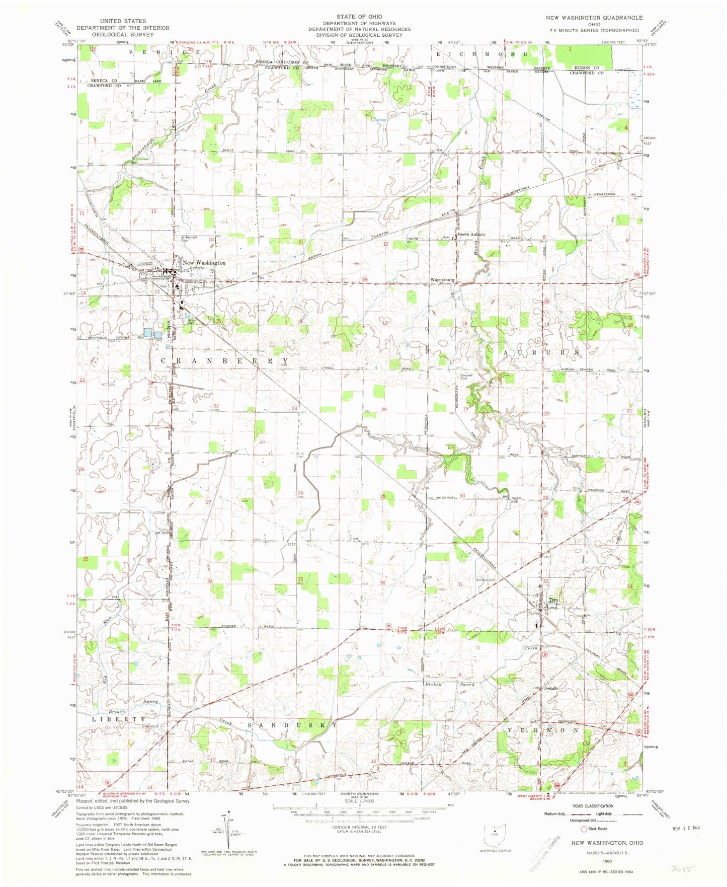
Classic USGS New Washington Ohio 7.5'x7.5' Topo Map
Couldn't load pickup availability
Historical USGS topographic quad map of New Washington in the state of Ohio. Map scale may vary for some years, but is generally around 1:24,000. Print size is approximately 24" x 27"
This quadrangle is in the following counties: Crawford, Huron, Seneca.
The map contains contour lines, roads, rivers, towns, and lakes. Printed on high-quality waterproof paper with UV fade-resistant inks, and shipped rolled.
Contains the following named places: Ackerman Farms, Buckeye Central High School, Buckeye East Elementary School, Cranberry Hills Golf Course, De Kalb Post Office, Dekalb, Dickson Cemetery, Goodwill Cemetery, Kaple Farms, Keller School, Liberty School, Lutheran Cemetery, Maple Grove School, Mechanicsburg, Muck School, New Washington, New Washington Fire Department, New Washington Post Office, New Washington Upground Reservoir, New Washington Upground Reservoir Dam, North Auburn, North Auburn Post Office, Oakland Cemetery, Our Mother of Sorrows Cemetery, Red Run, Ridge School, Saint Bernard Cemetery, School Number 1, School Number 2, Springer School, Tabor School, Tiro, Tiro - Auburn Volunteer Fire Department, Tiro Post Office, Township of Auburn, Township of Cranberry, Union Cemetery, Village of New Washington, Village of Tiro, Waynesburg, ZIP Codes: 44854, 44887