MyTopo
Classic USGS New York Mills NW Minnesota 7.5'x7.5' Topo Map
Couldn't load pickup availability
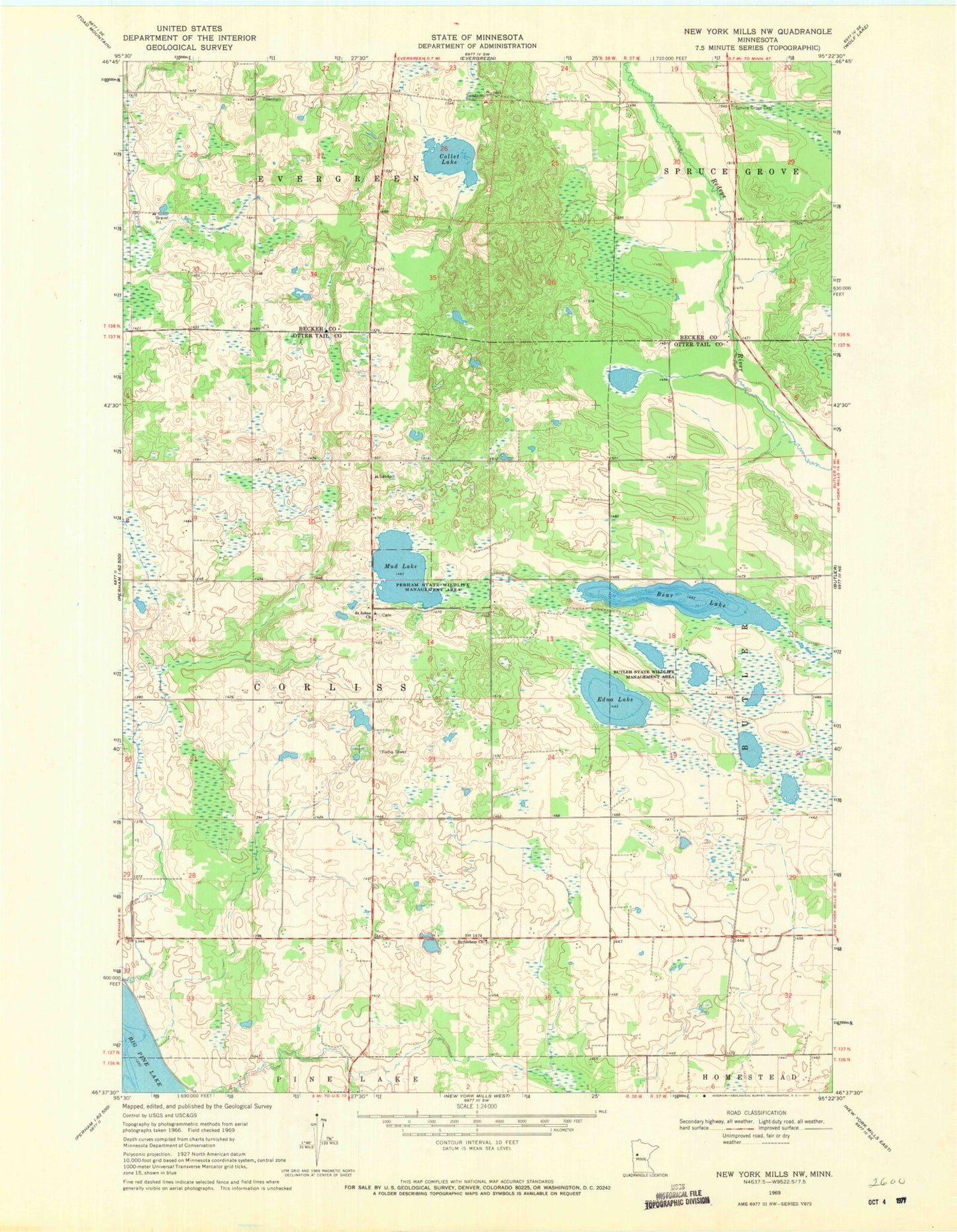
Historical USGS topographic quad map of New York Mills NW in the state of Minnesota. Map scale may vary for some years, but is generally around 1:24,000. Print size is approximately 24" x 27"
This quadrangle is in the following counties: Becker, Otter Tail.
The map contains contour lines, roads, rivers, towns, and lakes. Printed on high-quality waterproof paper with UV fade-resistant inks, and shipped rolled.
Contains the following named places: Bear Lake, Bethlehem Cemetery, Bethlehem Church, Butler State Wildlife Management Area, Collett Lake, Edma Lake, Mud Lake, Perham State Wildlife Management Area, Saint Johns Church, Spruce Grove Cemetery, St Johns Lutheran Church North Cemetery, Township of Corliss, Willow Creek Dairy Farm