MyTopo
Classic USGS Newark Arkansas 7.5'x7.5' Topo Map
Couldn't load pickup availability
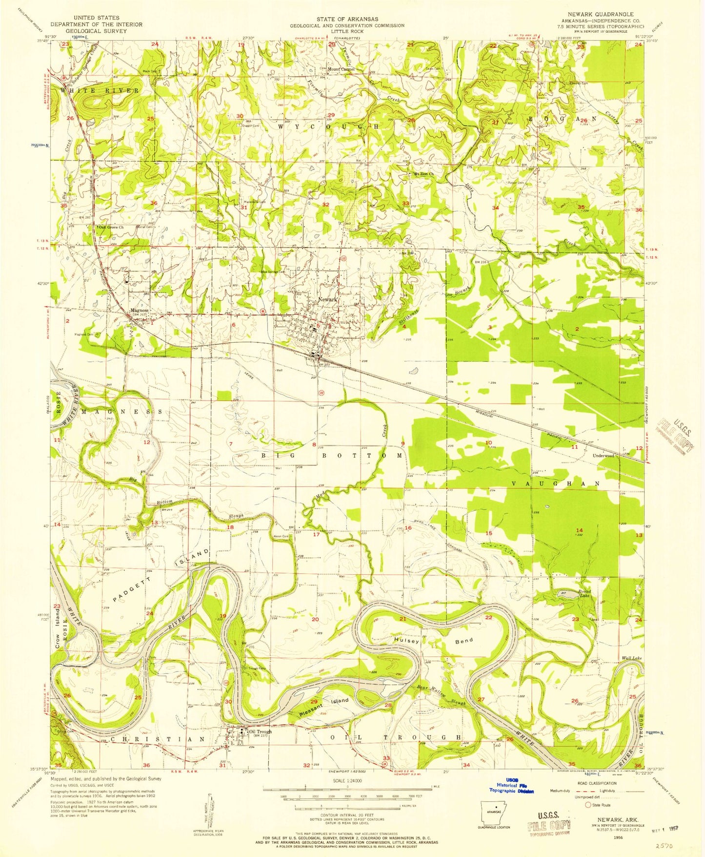
Historical USGS topographic quad map of Newark in the state of Arkansas. Map scale may vary for some years, but is generally around 1:24,000. Print size is approximately 24" x 27"
This quadrangle is in the following counties: Independence.
The map contains contour lines, roads, rivers, towns, and lakes. Printed on high-quality waterproof paper with UV fade-resistant inks, and shipped rolled.
Contains the following named places: Akron, Akron Cemetery, Bear Wallow Slough, Big Bottom Slough, Blue Springs Cemetery, Caster Bend, Cedar Ridge High School, City of Newark, Crow Island, Dugger Cemetery, Dunnington, Eaves Cemetery, Edwards Cemetery, Ellison Cemetery, Fetser Cemetery, Feutral Cemetery, Fivemile Creek, Gibbs Creek, Hulsey Bend, Independence Power Plant, KLEP-TV (Newark), KLLN-FM (Newark), Macedonia Cemetery, Mack Cemetery, Magness, Magness Cemetery, Magness Post Office, Mount Carmel, Mount Zion, Mount Zion Church, Mud Creek, Mud Creek Site One Dam, Mud Creek Site One Reservoir, Newark, Newark Elementary School, Newark High School, Newark Post Office, Newark Volunteer Fire Station, Oak Grove Church, Oil Trough, Oil Trough Elementary School, Oil Trough Ferry, Oil Trough Fire Department, Oil Trough High School, Oil Trough Post Office, Padgett Island, Pleasant Island, Round Lake, Stillhouse Branch, Sulphur Springs Creek, Swan Lake Drainage Ditch, Thompson Creek, Town of Magness, Town of Oil Trough, Township of Big Bottom, Township of Big Bottom-Wycough-Logan, Township of Magness, Township of Vaughn, Township of Wycough, Twomile Creek, Underwood, Wall Lake, ZIP Codes: 72553, 72562