MyTopo
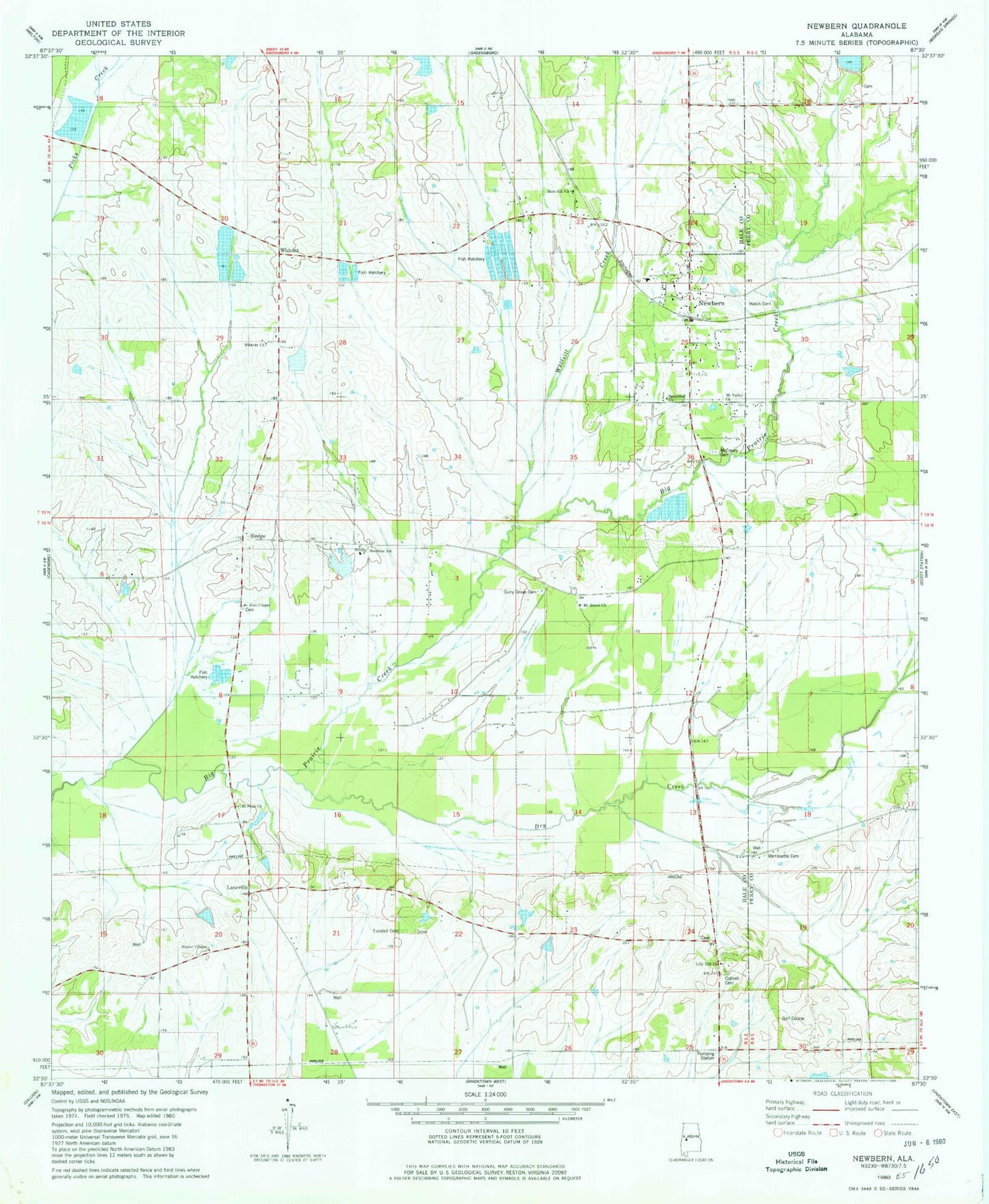
Classic USGS Newbern Alabama 7.5'x7.5' Topo Map
Couldn't load pickup availability
Historical USGS topographic quad map of Newbern in the state of Alabama. Map scale may vary for some years, but is generally around 1:24,000. Print size is approximately 24" x 27"
This quadrangle is in the following counties: Hale, Perry.
The map contains contour lines, roads, rivers, towns, and lakes. Printed on high-quality waterproof paper with UV fade-resistant inks, and shipped rolled.
Contains the following named places: Alex Chapel, Alexander Cemetery, B W Coleman Farm Dam Number 1, B W Coleman Farm Dam Number 2, Bester, Blacksand, Coleman Farm Ponds, Cottrell Cemetery, Cottrell Lake Dam, Curry Grove Cemetery, Dry Creek, Fowler Cemetery, Frank Watford Stadium, Hardenbergh Lake, Hatch Cemetery, Hunter Chapel, Hunter Chapel Cemetery, Jack Hardenbergh Dam, Jollywell Branch, Jones School, Kyser Lakes, Kyser Lakes Dam Number 4, Kyser Lakes Dam Number 5, Kyser Lakes Dam Number 6, Laneville, Lily Hill Church, Mars Hill Church, McCreary Cemetery, Morrissette Cemetery, Mount Horeb Church, Mount Sinai Church, Mount Valley Church, Newbern, Newbern Baptist Church, Newbern Cemetery, Newbern Junior High School, Newbern Methodist Church, Newbern Post Office, Newbern Presbyterian Church, Newburn Volunteer Fire Department, Pickens Mill, Posey Branch, Sanctified Church, Sledge, Sunshine, Sunshine Church, Sunshine High School, Town of Newbern, Tunstall Cemetery, Walthall Lake, Walthall Lake Dam, Whitsitt, Whitsitt Church, Whitsitt Creek, William Dale Dam, William Dale Lake, Willie Woods Dam Number 1, Willie Woods Dam Number 2, Willie Woods Dam Number 3, Willie Woods Lake, ZIP Code: 36765