MyTopo
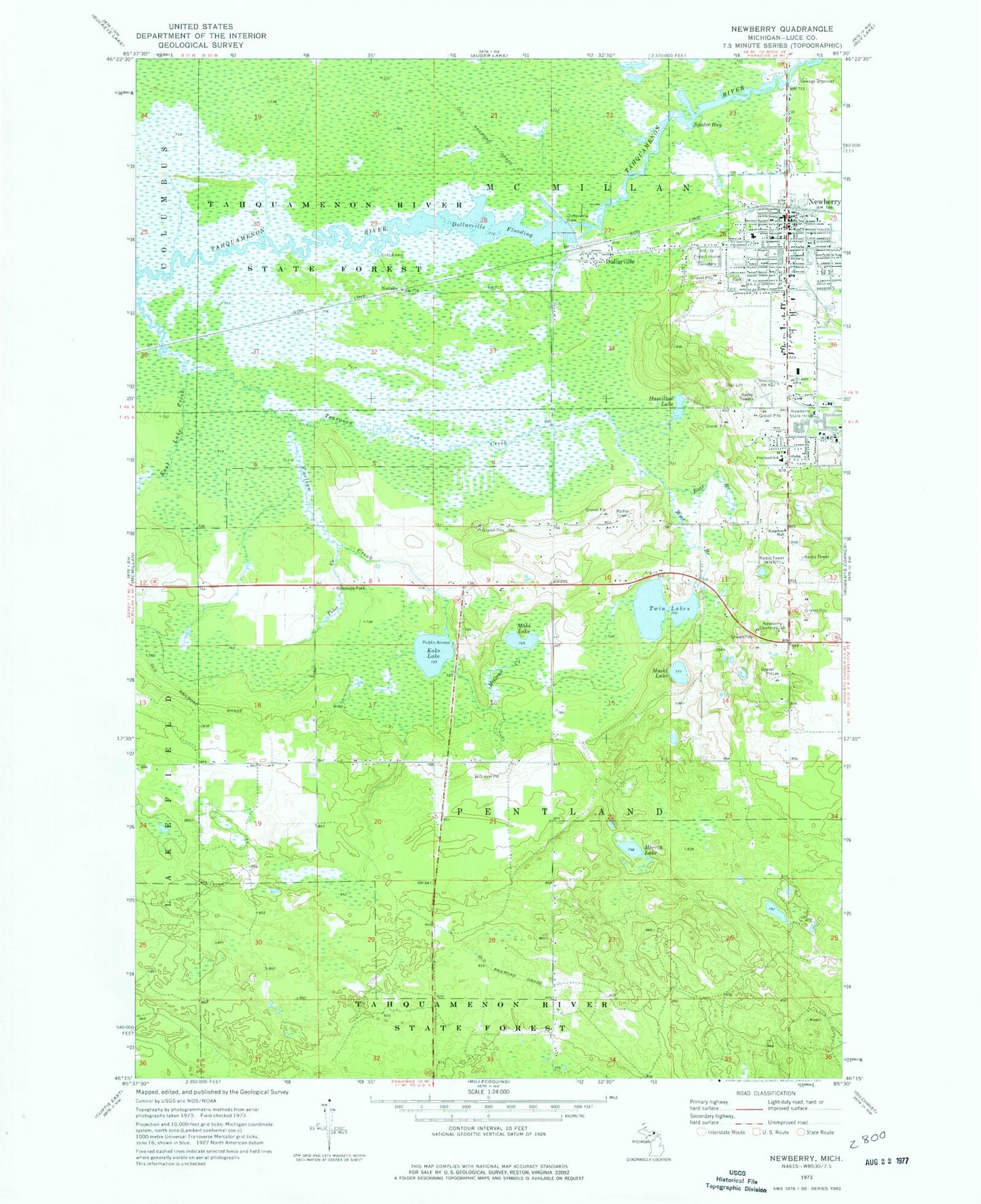
Classic USGS Newberry Michigan 7.5'x7.5' Topo Map
Couldn't load pickup availability
Historical USGS topographic quad map of Newberry in the state of Michigan. Typical map scale is 1:24,000, but may vary for certain years, if available. Print size: 24" x 27"
This quadrangle is in the following counties: Luce.
The map contains contour lines, roads, rivers, towns, and lakes. Printed on high-quality waterproof paper with UV fade-resistant inks, and shipped rolled.
Contains the following named places: Brant Creek, Carlson Creek, Dollarville, Dollarville Dam, Dollarville Flooding, East Branch Teaspoon Creek, East Lake Creek, Forest Home Cemetery, Hamilton Lake, Kaks Lake, Macki Lake, Maki Lake, McGraw Creek, Mervin Lake, Newberry, Newberry State Hospital, Pentland School, Petes Creek, Spider Bay, Twin Lakes, West Branch Teaspoon Creek, Natalie, Newberry Country Club, WNBY-AM (Newberry), WNBY-FM (Newberry), WUPQ-FM (Newberry), Tahquamenon Logging Museum, Newberry Police Department, Newberry Station, Newberry Post Office, Newberry Fire Department, Newberry State Bank Historical Marker, Jail and Sheriff's Residence Historical Marker, Luce County Sheriff's Office, Luce County Courthouse, Newberry High School, Kingdom Hall of Jehovah's Witnesses, First Baptist Church, Trinity Lutheran Church, First Presbyterian Church, Our Redeemer Lutheran Church, All Saints Episcopal Church, United Methodist Church, Saint Gregory's Catholic Church, Spine and Sport Clinic, Helen Newberry Joy Hospital, Church of Christ, Newberry KOA Campgrounds, Big Valley Ski Area, Natalie State Forest Campground, Watson's Corner, Bethel Church, Dollarville Station, Dollarville Post Office (historical), Village of Newberry, Michigan Department of Natural Resources Newberry Field Office, Luce County Ambulance Service, Newberry Correctional Facility