MyTopo
Classic USGS Newburg SW North Dakota 7.5'x7.5' Topo Map
Regular price
$16.95
Regular price
Sale price
$16.95
Unit price
per
Couldn't load pickup availability
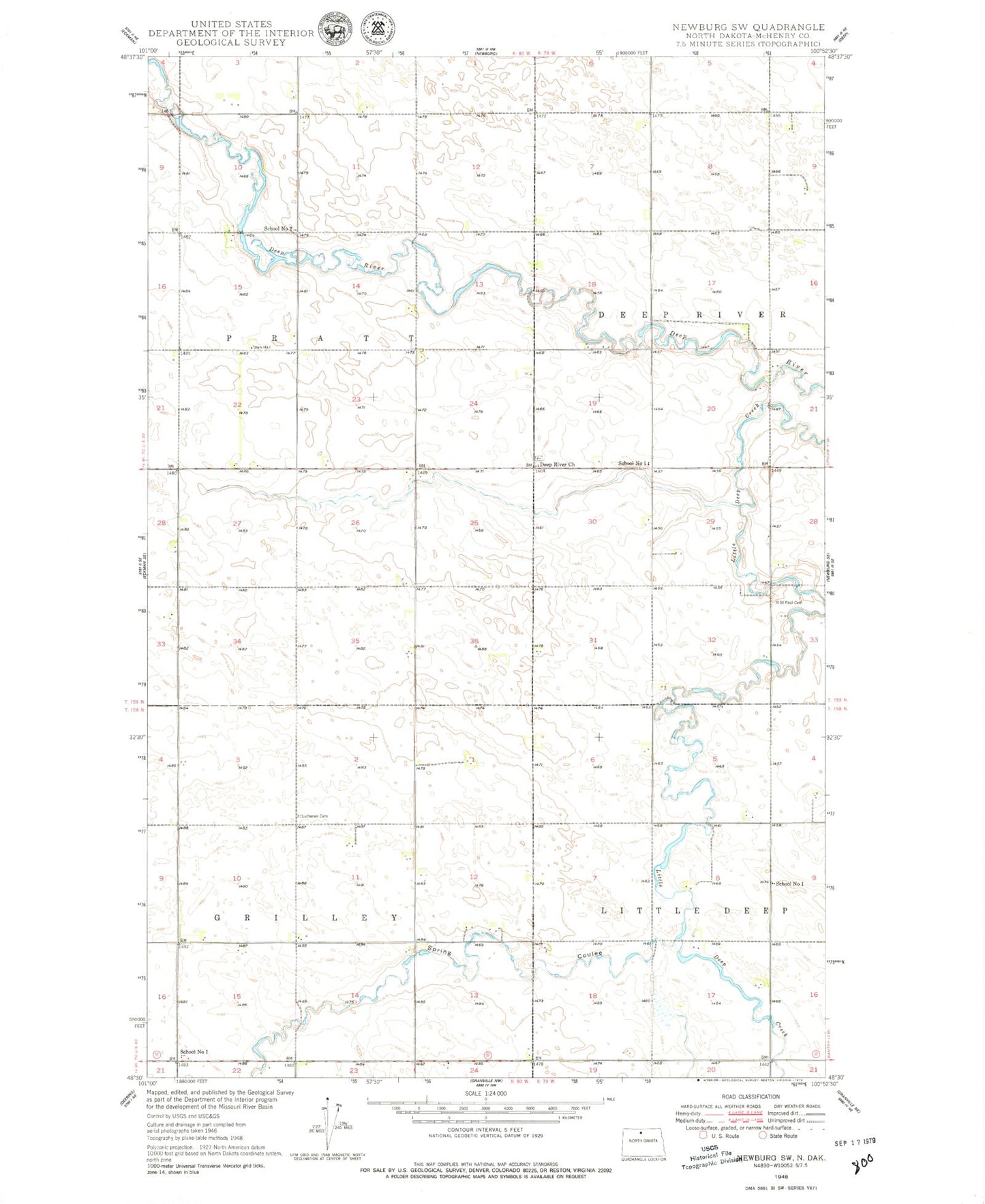
Historical USGS topographic quad map of Newburg SW in the state of North Dakota. Map scale may vary for some years, but is generally around 1:24,000. Print size is approximately 24" x 27"
This quadrangle is in the following counties: McHenry.
The map contains contour lines, roads, rivers, towns, and lakes. Printed on high-quality waterproof paper with UV fade-resistant inks, and shipped rolled.
Contains the following named places: Bethlehem Lutheran Cemetery, Deep River Church, Marsh Brothers Airstrip, Pfau Private Airport, Saint Paul Cemetery, School Number 1, School Number 2, Spring Coulee, Spring Coulee Norwegian Lutheran Cemetery, Township of Grilley, Township of Pratt, Welstad Farms Airstrip