MyTopo
Classic USGS Newburg Alabama 7.5'x7.5' Topo Map
Couldn't load pickup availability
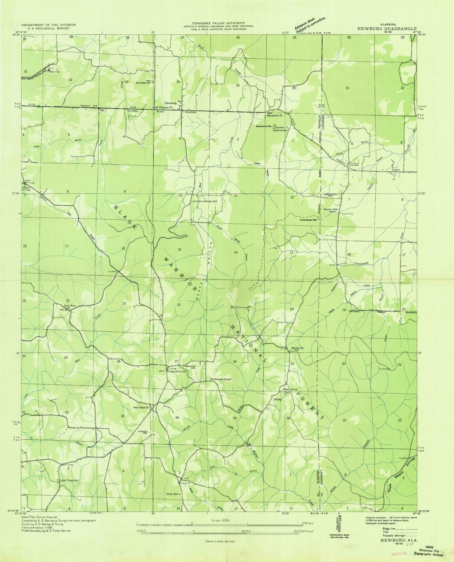
Historical USGS topographic quad map of Newburg in the state of Alabama. Map scale may vary for some years, but is generally around 1:24,000. Print size is approximately 24" x 27"
This quadrangle is in the following counties: Franklin, Lawrence.
The map contains contour lines, roads, rivers, towns, and lakes. Printed on high-quality waterproof paper with UV fade-resistant inks, and shipped rolled.
Contains the following named places: Atwood Branch, Beulah Cemetery, Beulah Church, Borden Branch, Cherry Hill Cemetery, Cherry Hill Church, Cherry Hill School, Coffin Hollow, County Line School, Denton Hollow, Denton Hollow Cemetery, Duboise Cemetery, East Franklin Junior High School, East Franklin Volunteer Fire Department, Eckerberger Mountain, Gray Rock Cemetery, Gray Rock Church, Hooker Spring Branch, Kimbrough Chapel, Kimbroughs Chapel Cemetery, Kirby Store, Light House Church, Little Branch, Macedonia Cemetery, Macedonia Church, Macedonia Mountain, McBrayer Lake, McNair Creek, Mount Pleasant Cemetery, Mount Pleasant United Methodist Church, Mountain Home Church, New Hope Church, Newburg, Oak Grove, Oak Grove Cemetery, Oak Grove Church, Pine Chapel, Piney Grove School, Pleasant Hill Church, Robertson Creek, Robertsons Lake, Rocky Branch, Sand Pit New Hope Church Dam, Sand Pit New Hope Church Lake, Steele Hollow, Stillhouse Hollow, Sylvester Cemetery, Sylvester Church, Tanyard Branch, Templeton Cemetery, Town Creek Watershed Dam Number 11, Town Creek Watershed Dam Number 12, Trapp School, Union, Union Church, Union Junior High School, West Store, Woodall Creek