MyTopo
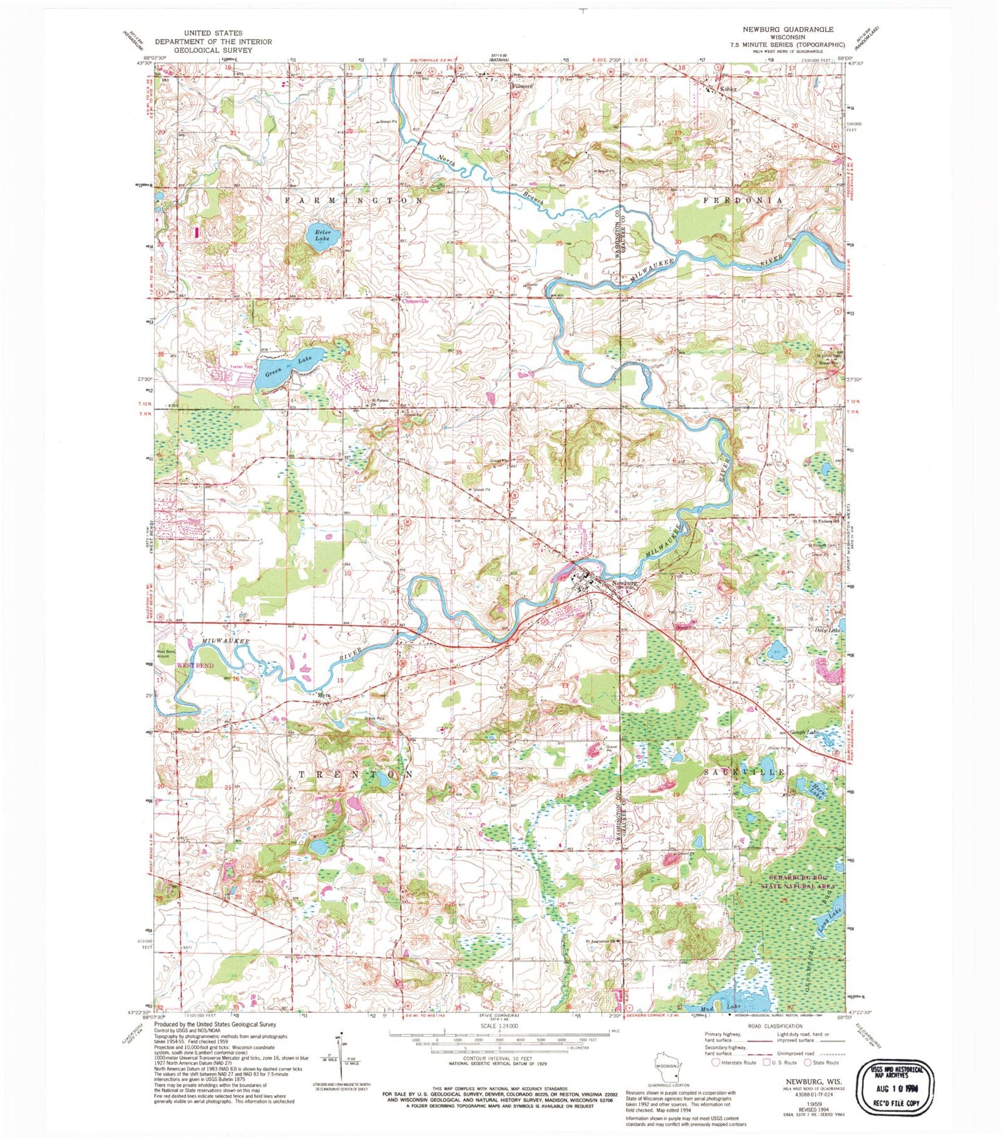
Classic USGS Newburg Wisconsin 7.5'x7.5' Topo Map
Couldn't load pickup availability
Historical USGS topographic quad map of Newburg in the state of Wisconsin. Map scale may vary for some years, but is generally around 1:24,000. Print size is approximately 24" x 27"
This quadrangle is in the following counties: Ozaukee, Washington.
The map contains contour lines, roads, rivers, towns, and lakes. Printed on high-quality waterproof paper with UV fade-resistant inks, and shipped rolled.
Contains the following named places: Cedarburg Beech Woods State Natural Area, Cedarburg Bog, Cedarburg Bog State Natural Area, Cheeseville, Cheeseville Dairy, Decorah Farm, Donut Lake, Erler Lake, Fillmore, Fillmore Fire Department, Gough Lake, Green Lake, Holy Trinity Cemetery, Horn Lake, Kohler, Long Lake, Myra, Newburg, Newburg Dam, Newburg Fire Department, Newburg Police Department, Newburg Pond 243, Newburg Post Office, North Branch Milwaukee River, Proschinger Lake, Radtke Lake, Riveredge Creek And Ephemeral Pond State Nature Preserve, Roeckl Lake, Saint Augustine Catholic Church, Saint Augustine Cemetery, Saint Finbars Cemetery, Saint Finbars School, Saint Johns Cemetery, Saint Johns Lutheran School, Saint Peters Church, Sapa Spruce Bog State Natural Area, Town of Farmington, Town of Trenton, Trenton Police Department, Village of Newburg, ZIP Code: 53021